Traverse Mountains
| Traverse Mountains | |
|---|---|
 | |
| Highest point | |
| Coordinates | 40°28′19″N 111°52′59″W / 40.47189°N 111.88299°WCoordinates: 40°28′19″N 111°52′59″W / 40.47189°N 111.88299°W |
| Geography | |
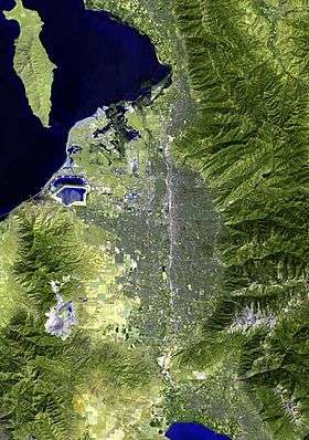
 Traverse Mountains Location of the Traverse Mountains within the State of Utah | |
| Country | United States |
| State | Utah |
The Traverse Mountains, or sometimes Traverse Range, are an anomalous, geologically complex, east-trending range that separates Salt Lake Valley and Utah Valley in the U.S. State of Utah.[1] Point of the Mountain is colloquially used to refer to the part of this range that separates the Salt Lake City and Provo metropolitan areas, as well as the mountain pass at 40°27′13″N 111°54′38″W / 40.45361°N 111.91056°W,[2] used by the highways and rail arteries that connect the two cities.
Description
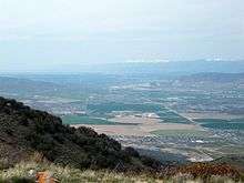
The Traverse Mountains mark the boundary between the Salt Lake and Provo segments of the Wasatch Fault, and they are themselves much faulted and locally involved in landslides. Lake Bonneville once covered Salt Lake and Utah Valleys and shorelines and deposits from the ice age lake are now etched into the flanks of the Traverse Mountains.
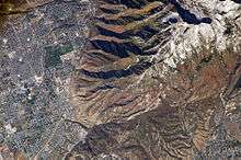
The eastern section of the range (often called Traverse Mountain), is split up between the cities of Lehi and Draper. The Draper portion contains the Suncrest community, while the Lehi portion contains the Traverse Mountain community. Between the two communities, the Flight Park State Recreation Area (state park) sit atop the range. The western section of the range is part of the Camp Williams National Guard Training Site.
Two locations on the far west end of the eastern section of the range are Point of the Mountain and Steep Mountain, 6,160 feet (1,878 m),[3] and are used for paragliding and hang gliding.
See also
References
- ↑ U.S. Geological Survey Geographic Names Information System: Traverse Mountains
- ↑ U.S. Geological Survey Geographic Names Information System: Point of the Mountain
- ↑ Utah, DeLorme Atlas & Gazetteer, p. 24-25. (west range terminus)
External links
![]()