Trapper Peak (Montana)
| Trapper Peak | |
|---|---|
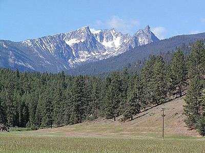
 Trapper Peak, as seen from the Boulder Point Lookout | |
| Highest point | |
| Elevation | 10,157 ft (3,096 m) [1] |
| Prominence | 3,570 ft (1,090 m) [1] |
| Coordinates | 45°53′24″N 114°17′51″W / 45.8899191°N 114.2975884°WCoordinates: 45°53′24″N 114°17′51″W / 45.8899191°N 114.2975884°W [2] |
| Geography | |
 Trapper Peak | |
| Parent range | Bitterroot Mountains |
| Topo map | USGS Trapper Peak, MT |
| Climbing | |
| Easiest route | Hike |
Trapper Peak is the highest point in the Bitterroot Mountains, part of the larger Bitterroot Range in western Montana. It rises over 6,000 feet (1,830 m) above the nearby Bitterroot Valley.
The peak is located within the Central Bitterroot Range, a subrange of the Bitterroot Mountains and within the Selway-Bitterroot Wilderness Area of the Bitterroot National Forest.
A trail to the peak climbs 3,800 feet (1,160 m) from the end of a Forest Service road.
References
- 1 2 "Trapper Peak". Bivouac.com. Retrieved 2008-12-20.
- ↑ "Trapper Peak". Geographic Names Information System. United States Geological Survey.
Trapper Peak from US 93 near Conner, Montana.
External links
- "Trapper Peak". SummitPost.org.
- "Trapper Peak, Montana". Peakbagger.com.
| Wikimedia Commons has media related to Bitterroot Mountains. |
This article is issued from
Wikipedia.
The text is licensed under Creative Commons - Attribution - Sharealike.
Additional terms may apply for the media files.