Tranøya (Tranøy)
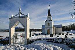 View of the church on the island | |
 Tranøya Location of the island  Tranøya Tranøya (Norway) | |
| Geography | |
|---|---|
| Location | Troms, Norway |
| Coordinates | 69°08′41″N 17°25′48″E / 69.1447°N 17.4300°ECoordinates: 69°08′41″N 17°25′48″E / 69.1447°N 17.4300°E |
| Area | 1.18 km2 (0.46 sq mi) |
| Length | 1.7 km (1.06 mi) |
| Width | 1 km (0.6 mi) |
| Highest elevation | 32 m (105 ft) |
| Highest point | Kongshågen |
| Administration | |
|
Norway | |
| County | Troms |
| Municipality | Tranøy Municipality |
Tranøya is an island in Tranøy Municipality in Troms county, Norway. It is located in the Solbergfjorden, about 1 kilometre (0.62 mi) south of the large island of Senja. The 1.18-square-kilometre (0.46 sq mi) island is almost totally uninhabited. There is one farm area on the eastern side of the island. The farm is also the site of the historic Tranøy Church. Today the farm is owned by the local government and used as a retirement and assisted living facility. There is also a small museum on the site.[1]
See also
References
- ↑ "Tranøy (Senja)" (in Norwegian). Turliv.no.
This article is issued from
Wikipedia.
The text is licensed under Creative Commons - Attribution - Sharealike.
Additional terms may apply for the media files.