Toyosu Station
Toyosu Station 豊洲駅 | |
|---|---|
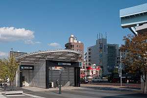 Exit 7 of the Tokyo Metro station in September 2011, with the end of the elevated Yurikamome tracks just visible | |
| Location |
Toyosu, Kōtō-ku, Tokyo Japan |
| Operated by |
|
| Line(s) | |
| Connections | Bus terminal |
| History | |
| Opened | 8 June 1988 |
| Location | |
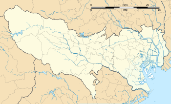 Toyosu Station Location within Tokyo  Toyosu Station Toyosu Station (Japan) | |
Toyosu Station (豊洲駅 Toyosu-eki) is a railway station in Kōtō, Tokyo, Japan, operated by Tokyo Metro and Tokyo Waterfront New Transit Corporation.
Lines
Toyosu Station is served by the Tokyo Metro Yurakucho Line subway and the Yurikamome.
Station layout
The station consists of an underground metro station (numbered Y-22) on the Tokyo Metro Yurakucho Line, and an elevated station forming the eastern terminus of the Yurikamome Line (station number U-16).
Tokyo Metro
Y22 Toyosu Station 豊洲駅 | |
|---|---|
| Tokyo Metro station | |
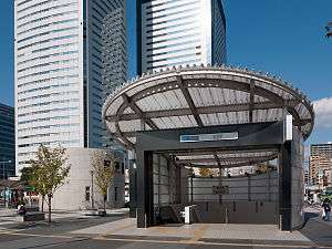 Exit 7 of the Tokyo Metro station in September 2011 | |
| Location |
4-1-1 Toyosu, Kōtō-ku, Tokyo Japan |
| Operated by |
|
| Line(s) |
|
| Distance | 25.1 from Wakōshi |
| Platforms | 2 island platforms |
| Tracks | 2 |
| Construction | |
| Structure type | Underground |
| Other information | |
| Station code | Y-22 |
| Website | Official website |
| History | |
| Opened | 8 June 1988 |
| Traffic | |
| Passengers (FY2012) | 160,196 daily |
Platforms
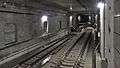
The subway station has two island platforms located on the third basement ("B3F") level, serving four tracks. The two centre tracks were completed on 1 March 2013, for use by terminating services from the start of the revised timetable on 16 March 2013.[1]
| 1 | ○ Tokyo Metro Yurakucho Line | for Shin-kiba |
| 2 | ○ Tokyo Metro Yurakucho Line | (Terminating trains only) |
| 3/4 | ○ Tokyo Metro Yurakucho Line | for Ikebukuro and Wakōshi Tobu Tojo Line for Shinrinkōen Seibu Ikebukuro Line for Hannō |
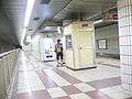
 The buffer stops at the south end of tracks 2 and 3 in July 2013
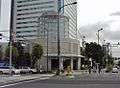 Exit 3 of the Tokyo Metro station in October 2007
Adjacent stations
| « | Service | » | ||
|---|---|---|---|---|
| Tokyo Metro Yurakucho Line (Y-22) | ||||
| Yurakucho (Y-18) | S-Train (weekdays) |
Terminus | ||
| Tsukishima (Y-21) | - | Tatsumi (Y-23) | ||
Yurikamome
 Toyosu Station 豊洲駅 | |
|---|---|
| Yurikamome station | |
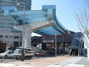 The Yurikamome station in 2006 | |
| Location |
Toyosu, Kōtō-ku, Tokyo Japan |
| Operated by | Tokyo Waterfront New Transit Corporation |
| Line(s) | Yurikamome |
| Distance | 14.7 km from Shimbashi |
| Platforms | 1 island platform |
| Tracks | 2 |
| Construction | |
| Structure type | Elevated |
| Other information | |
| Station code | U-16 |
| Website | Official website |
| History | |
| Opened | 27 March 2006 |
Platforms
The station consists of a single elevated island platform serving two terminating tracks.
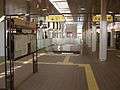 The Yurikamome platforms in December 2008
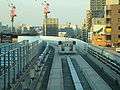 View from the end of the platforms looking northward in April 2007
Adjacent stations
| « | Service | » | ||
|---|---|---|---|---|
| Yurikamome | ||||
| Shin-toyosu | - | Terminus | ||
History
The subway station opened on 8 June 1988 when the Yurakucho Line was extended from Shintomichō to Shin-kiba.[2] The Yurikamome station opened on 27 March 2006 when the line was extended from Ariake.[2]
The Tokyo Metro station platforms were renumbered 1 to 4 from 1 March 2013 following completion of the two centre tracks for use by terminating trains.[1]
 The Yurakucho Line platforms in 2005 with fences on the inner sides of the platforms
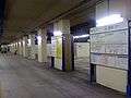 The Yurakucho Line platforms in 2010, with a temporary surface over the centre tracks
Passenger statistics
In fiscal 2012, the Tokyo Metro station was used by an average of 160,196 passengers daily.[3] The passenger figures for previous years are as shown below.
| Fiscal year | Daily average |
|---|---|
| 2010 | 138,876[4] |
| 2011 | 154,214[5] |
| 2012 | 160,196[3] |
Surrounding area
Toyosu has gained popularity due to the increase in high-rise apartments, such as Park City Toyosu, The Toyosu Tower, City Towers Toyosu, and the large shopping mall known as Lalaport Toyosu.
Other places of note in the vicinity include the following.
- Gas Science Museum
- Shibaura Institute of Technology
- Showa University Toyosu Hospital
- Toyosu Library
- Fukagawa No. 5 Junior High School
- Toyosu Elementary School
- Toyosu-kita Elementary School
See also
References
- 1 2 有楽町線豊洲駅で中線の入線試運転 [Test running starts on centre tracks at Toyosu Station on the Yurakucho Line]. Japan Railfan Magazine Online (in Japanese). Japan: Koyusha Co., Ltd. 5 March 2013. Retrieved 5 March 2013.
- 1 2 Terada, Hirokazu (19 January 2013). データブック日本の私鉄 [Databook: Japan's Private Railways]. Japan: Neko Publishing. pp. 216–220. ISBN 978-4-7770-1336-4.
- 1 2 各駅の乗降人員ランキング 2012年度 [Station passenger figures (fiscal 2012)] (in Japanese). Japan: Tokyo Metro. 2013. Retrieved 15 July 2013.
- ↑ 各駅の乗降人員ランキング 2010年度 [Station passenger figures (fiscal 2010)] (in Japanese). Japan: Tokyo Metro. 2011. Retrieved 15 July 2013.
- ↑ 各駅の乗降人員ランキング 2011年度 [Station passenger figures (fiscal 2011)] (in Japanese). Japan: Tokyo Metro. 2012. Retrieved 15 July 2013.
External links
| Wikimedia Commons has media related to Toyosu Station. |
- Toyosu Station information (Tokyo Metro) (in Japanese)
- Toyosu Station information (Yurikamome)
Coordinates: 35°39′18″N 139°47′46″E / 35.654995°N 139.796079°E