Townsville, North Carolina
Coordinates: 36°29′41″N 78°25′25″W / 36.49472°N 78.42361°W Townsville is an unincorporated community in northern Vance County, North Carolina, United States. It is located at the intersection of N.C. Highway 39 and Tungsten Mine Road (SR 1348), 13 miles (21 km) north of Henderson, at an elevation of 427 feet (130 m).[1] Townsville is near the John H. Kerr Reservoir and Virginia state line.
A United States Post Office is located in Townsville with a ZIP Code of 27584.[2]
Machpelah was listed on the National Register of Historic Places in 2007.[3]
References
- ↑ North Carolina Department of Transportation: State Mapping Resources -- Vance County, Retrieved Jan. 15, 2015.
- ↑ United States Postal Service (Townsville, North Carolina Post Office), Retrieved Jan. 16, 2015.
- ↑ National Park Service (2010-07-09). "National Register Information System". National Register of Historic Places. National Park Service.
Municipalities and communities of Vance County, North Carolina, United States | ||
|---|---|---|
| City | 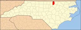 | |
| Towns | ||
| CDP | ||
| Unincorporated communities |
| |
| Footnotes | ‡This populated place also has portions in an adjacent county or counties | |
This article is issued from
Wikipedia.
The text is licensed under Creative Commons - Attribution - Sharealike.
Additional terms may apply for the media files.