Townsend, Georgia
| Townsend | |
|---|---|
| Unincorporated community | |
 Townsend Location within the state of Georgia  Townsend Townsend (the US) | |
| Coordinates: 31°32′22″N 81°31′21″W / 31.53944°N 81.52250°WCoordinates: 31°32′22″N 81°31′21″W / 31.53944°N 81.52250°W | |
| Country | United States |
| State | Georgia |
| County | McIntosh |
| Elevation | 20 ft (6 m) |
| Time zone | UTC-5 (Eastern (EST)) |
| • Summer (DST) | UTC-4 (EDT) |
| ZIP codes | 31331 |
| GNIS feature ID | 324263 |
Townsend is an unincorporated community in McIntosh County, Georgia, United States. It lies along State Route 57 northwest of the city of Darien, the county seat.[1] Its elevation is 20 feet (6 m).[2] Although it is unincorporated, it has a post office, with the ZIP code of 31331.[3]
Townsend includes the United States Marine Corps's Townsend Bombing Range, which is an over 34,000 acre area used for combat training by all the U.S. military branches' pilots.[4]
References
- ↑ Rand McNally. The Road Atlas '06. Chicago: Rand McNally, 2006, p. 29.
- ↑ U.S. Geological Survey Geographic Names Information System: Townsend, Georgia, Geographic Names Information System, 1979-09-25. Accessed 2008-02-17.
- ↑ Zip Code Lookup
- ↑ "Possible bombing range expansion fires up residents". WTOC TV. Retrieved 19 December 2016.
Municipalities and communities of McIntosh County, Georgia, United States | ||
|---|---|---|
| City | 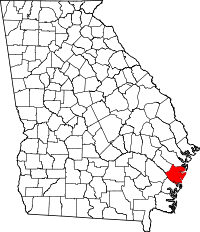 | |
| Unincorporated communities | ||
This article is issued from
Wikipedia.
The text is licensed under Creative Commons - Attribution - Sharealike.
Additional terms may apply for the media files.