Tooraneena
| Tooraneena Irish: Tuar an Fhíona | |
|---|---|
| Village | |
 Tooraneena Location in Ireland | |
| Coordinates: 52°12′08″N 7°42′56″W / 52.202202°N 7.715669°WCoordinates: 52°12′08″N 7°42′56″W / 52.202202°N 7.715669°W | |
| Country | Ireland |
| Province | Munster |
| County | Waterford |
| Time zone | UTC+0 (WET) |
| • Summer (DST) | UTC-1 (IST (WEST)) |
Tooraneena[1][2] or Touraneena (Irish: Tuar an Fhíona) is a village in west County Waterford, Ireland. It lies in the Sliabh gCua district between the Comeraghs and Knockmealdown Mountains. It may be accessed from the main R672 road between Clonmel and Dungarvan. It is about 20 km (12 mi) from Dungarvan and 19 km (12 mi) from Clonmel.
Amenities
The village includes St Mary's National School (primary school), a playing field, community hall, Catholic church, two public houses, a shop and a community park. Gaelic Athletic Association (GAA) playing fields lie about 1 km to the north.[3]
References
Places in County Waterford | ||
|---|---|---|
| Towns | 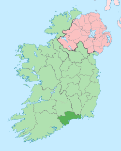 | |
| Villages and Townlands |
| |
| ||
This article is issued from
Wikipedia.
The text is licensed under Creative Commons - Attribution - Sharealike.
Additional terms may apply for the media files.