Tour Sallière
| Tour Sallière | |
|---|---|
 | |
| Highest point | |
| Elevation | 3,220 m (10,560 ft) |
| Prominence | 726 m (2,382 ft) [1] |
| Isolation | 3.8 km (2.4 mi) [2] |
| Parent peak | Dents du Midi (Haute Cime) |
| Coordinates | 46°7′36″N 6°55′28.2″E / 46.12667°N 6.924500°ECoordinates: 46°7′36″N 6°55′28.2″E / 46.12667°N 6.924500°E |
| Geography | |
 Tour Sallière Location in Switzerland | |
| Location | Valais, Switzerland |
| Parent range | Chablais Alps |
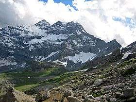
The Tour Sallière is a mountain of the Chablais Alps, that is overlooking the lake of Salanfe in the Swiss canton of Valais.
References
- ↑ Retrieved from the Swisstopo topographic maps. The key col is the Col de Susanfe (2,494 m).
- ↑ Retrieved from Google Earth. The nearest point of higher elevation is south of the Haute Cime des Dents du Midi.
External links
This article is issued from
Wikipedia.
The text is licensed under Creative Commons - Attribution - Sharealike.
Additional terms may apply for the media files.