Totnansberg
| Totnansberg | |
|---|---|
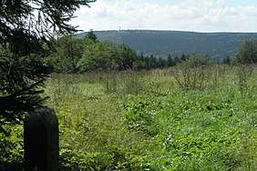 View of the Totnansberg from the area of the Kissinger Hut | |
| Highest point | |
| Elevation | 839.4 m above sea level (NHN) (2,754 ft) [1] |
| Prominence | 177 m ↓ Guckaspaß |
| Isolation | 6.0 km → Kreuzberg |
| Coordinates | 50°19′16″N 9°55′49″E / 50.32111°N 9.930167°ECoordinates: 50°19′16″N 9°55′49″E / 50.32111°N 9.930167°E |
| Geography | |
 Totnansberg | |
| Parent range | Rhön (Black Mountains) |
| Climbing | |
| Access | Forest tracks |
The Totnansberg, occasionally also called the Totmannsberg, is the highest peak in the Black Mountains, a subunit of the Rhön in central Germany.
References
This article is issued from
Wikipedia.
The text is licensed under Creative Commons - Attribution - Sharealike.
Additional terms may apply for the media files.