Torricelli Mountains
| Torricelli Mountains | |
|---|---|
 | |
| Elevation | 1,650 metres (5,410 ft) |
| Geography | |
| State | Papua New Guinea |
| Range coordinates | 3°23′00″S 142°15′00″E / 3.383333°S 142.25°ECoordinates: 3°23′00″S 142°15′00″E / 3.383333°S 142.25°E |
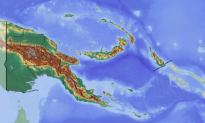
The Torricelli Mountains are a mountain range in Sandaun Province, north-western Papua New Guinea. The highest peak in the range is Mount Sulen at 1650 meters. The Bewani Mountains are located to the west, and the Prince Alexander Mountains are located to the east. To the north, the mountains slope down to the Pacific Ocean, and to the south lies the basin of the Sepik River.
Ecology
The portion of the range above 1000 meters elevation is home to the Northern New Guinea mountain rain forests ecoregion, which also extends across portions of the neighboring ranges. The slopes below 1000 meters are part of the Northern New Guinea lowland rain and freshwater swamp forests.[1]
Two of the most endangered mammals in the world, Scott’s tree-kangaroo (Dendrolagus scottae) and golden-mantled tree-kangaroo (Dendrolagus pulcherrimus), live in the mountains' rainforest.[2] Discovered in 1981, the critically endangered Northern glider (Petaurus abidi) occurs exclusively in an area of less than 100 km2 in the Torricelli Mountains.[3]
References
- ↑ "Northern New Guinea mountain rain forests". Terrestrial Ecoregions. World Wildlife Fund. Retrieved 2007-08-17.
- ↑ "Seacology Islands Project". Archived from the original on 2007-01-02. Retrieved 2007-01-09.
- ↑ "Petaurus abidi (Northern Glider)". www.iucnredlist.org. The IUCN Red List of Threatened Species. Retrieved 13 December 2016.
External links
- "Northern New Guinea montane rain forests". Terrestrial Ecoregions. World Wildlife Fund.