Torkofel
| Torkofel | |
|---|---|
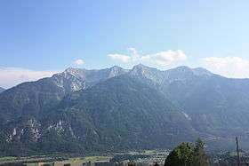 Torkofel (centre) as part of the Jauken Massif. | |
| Highest point | |
| Elevation | 2,276 m (7,467 ft) |
| Prominence | 661 m (2,169 ft) [1] |
| Coordinates | 46°42′N 13°05′E / 46.700°N 13.083°ECoordinates: 46°42′N 13°05′E / 46.700°N 13.083°E |
| Geography | |
 Torkofel Location in the Alps | |
| Location | Carinthia, Austria |
| Parent range | Gailtal Alps |
| Climbing | |
| First ascent | 1853 |
Torkofel (2,276 m) is a mountain of the Gailtal Alps in Carinthia, Austria. It is the highest summit of the Jauken Group, a small limestone massif west of Reißkofel. It lies between the Drava valley to the north and the Gail valley in the south. It was first climbed in 1853 by the Johann Festin von Wald and Paul Grohmann.[2]
References
- ↑ "Torkofel - peakbagger". peakbagger.com. Retrieved 9 March 2015.
- ↑ "Torkofel - summitpost". summitpost.org. Retrieved 9 March 2015.
This article is issued from
Wikipedia.
The text is licensed under Creative Commons - Attribution - Sharealike.
Additional terms may apply for the media files.