Tordouet
| Tordouet | ||
|---|---|---|
 | ||
| ||
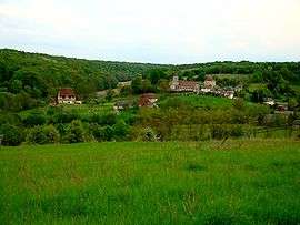
 Tordouet Location within Normandy region  Tordouet | ||
| Coordinates: 49°03′01″N 0°19′51″E / 49.0503°N 0.3308°ECoordinates: 49°03′01″N 0°19′51″E / 49.0503°N 0.3308°E | ||
| Country | France | |
| Region | Normandy | |
| Department | Calvados | |
| Arrondissement | Lisieux | |
| Canton | Livarot | |
| Intercommunality | Pays de l'Orbiquet | |
| Government | ||
| • Mayor (2008–2014) | Isabelle Rojkoff | |
| Area1 | 6.76 km2 (2.61 sq mi) | |
| Population (2008)2 | 280 | |
| • Density | 41/km2 (110/sq mi) | |
| Time zone | UTC+1 (CET) | |
| • Summer (DST) | UTC+2 (CEST) | |
| INSEE/Postal code | 14693 /14290 | |
| Elevation |
88–181 m (289–594 ft) (avg. 100 m or 330 ft) | |
|
1 French Land Register data, which excludes lakes, ponds, glaciers > 1 km2 (0.386 sq mi or 247 acres) and river estuaries. 2 Population without double counting: residents of multiple communes (e.g., students and military personnel) only counted once. | ||
.svg.png)
Tordouet is a former commune in the Calvados department in the Normandy region in northwestern France. On 1 January 2016, it was merged into the new commune of Valorbiquet.[1]
Population
| Historical population | ||
|---|---|---|
| Year | Pop. | ±% |
| 1793 | 1,275 | — |
| 1800 | 1,348 | +5.7% |
| 1806 | 1,350 | +0.1% |
| 1821 | 1,295 | −4.1% |
| 1831 | 1,142 | −11.8% |
| 1836 | 1,091 | −4.5% |
| 1841 | 1,045 | −4.2% |
| 1846 | 1,023 | −2.1% |
| 1851 | 963 | −5.9% |
| 1856 | 891 | −7.5% |
| 1861 | 929 | +4.3% |
| 1866 | 896 | −3.6% |
| 1872 | 725 | −19.1% |
| 1876 | 676 | −6.8% |
| 1881 | 605 | −10.5% |
| 1886 | 562 | −7.1% |
| 1891 | 501 | −10.9% |
| 1896 | 421 | −16.0% |
| 1901 | 385 | −8.6% |
| 1906 | 375 | −2.6% |
| 1911 | 334 | −10.9% |
| 1921 | 279 | −16.5% |
| 1926 | 301 | +7.9% |
| 1931 | 289 | −4.0% |
| 1936 | 296 | +2.4% |
| 1946 | 298 | +0.7% |
| 1954 | 297 | −0.3% |
| 1962 | 280 | −5.7% |
| 1968 | 273 | −2.5% |
| 1975 | 245 | −10.3% |
| 1982 | 271 | +10.6% |
| 1990 | 256 | −5.5% |
| 1999 | 293 | +14.5% |
| 2006 | 284 | −3.1% |
See also
References
- ↑ Arrêté préfectoral 9 December 2015 (in French)
| Wikimedia Commons has media related to Tordouet. |
This article is issued from
Wikipedia.
The text is licensed under Creative Commons - Attribution - Sharealike.
Additional terms may apply for the media files.