Chloeta, Oklahoma
Coordinates: 36°25′23″N 94°58′15″W / 36.42314°N 94.970792°W
Chloeta (or Topsy) is a small rural community located on State Highway 20 in Delaware County, Oklahoma, north of Spavinaw Lake. The post office existed from April 18, 1898, until January 31, 1914.
Sources
- Shirk, George H. Oklahoma Place Names. Norman: University of Oklahoma Press, 1987. ISBN 0-8061-2028-2 .
Municipalities and communities of Delaware County, Oklahoma, United States | ||
|---|---|---|
| Cities | 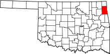 | |
| Towns | ||
| CDPs | ||
| Other unincorporated communities | ||
| Footnotes | ‡This populated place also has portions in an adjacent county or counties | |
This article is issued from
Wikipedia.
The text is licensed under Creative Commons - Attribution - Sharealike.
Additional terms may apply for the media files.