Tooraweenah
| Tooraweenah New South Wales | |
|---|---|
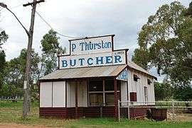 Historic butcher shop | |
|
Tooraweenah | |
| Coordinates | 31°26′20″S 148°54′40″E / 31.43889°S 148.91111°ECoordinates: 31°26′20″S 148°54′40″E / 31.43889°S 148.91111°E |
| Population | 239 (2006 census)[1] |
| Postcode(s) | 2817 |
| Location | |
| LGA(s) | Gilgandra Shire |
| State electorate(s) | Barwon |
| Federal Division(s) | Parkes |
Tooraweenah is a small village just off the Newell Highway about 44 km (27 mi) north east of Gilgandra in the central west of New South Wales, Australia. At the 2006 census, Tooraweenah had a population of 239.[1]
Land surrounding Tooraweenah is used for sheep grazing. It is also used for cattle grazing. In addition, it has seen use for goat grazing. Additionally, there is emu grazing. Also, there is broadscale grain cropping as well.
Tooraweenah is often the last stop for tourists on their way from Gilgandra to the Warrumbungle National Park.
Services
- caravan park
- pub
- post office
- hardware and agricultural supply store
- community technology centre
- automotive repair and fuelling
- aerodrome
Clubs
- tennis club,
- Lions Club,
- agricultural show society.
Telecommunications
- a Telstra Remote Integrated Multiplexor (RIM) provides PSTN telephony and ISDN, and ADSL,
- ABC broadcast FM radio transponders at nearby Needle Mountain (including 105.5 MHz Classic FM, 106.3 MHz News Radio, 107.1 MHz Local Radio, and 107.9 MHz Radio National),
- a UHF CB repeater on Channel 1,
- an amateur radio repeater on 146.8 MHz.
References
- 1 2 Australian Bureau of Statistics (25 October 2007). "Tooraweenah (State Suburb)". 2006 Census QuickStats. Retrieved 2008-11-20.
External links
![]()
- Tooraweenah.com community web hosting
This article is issued from
Wikipedia.
The text is licensed under Creative Commons - Attribution - Sharealike.
Additional terms may apply for the media files.