Timpas, Colorado
| Timpas, Colorado | |
|---|---|
| Unincorporated community | |
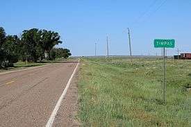 Timpas and U.S. Route 350. | |
 Location in Otero County and the state of Colorado  Timpas, Colorado (the US) | |
| Coordinates: 37°49′05″N 103°46′25″W / 37.81806°N 103.77361°WCoordinates: 37°49′05″N 103°46′25″W / 37.81806°N 103.77361°W | |
| Country |
|
| State |
|
| County | Otero County[1] |
| Elevation[1] | 4,430 ft (1,350 m) |
| Time zone | UTC-7 (MST) |
| • Summer (DST) | UTC-6 (MDT) |
| ZIP code[2] | 81050 (La Junta) |
| Area code(s) | 719 |
| GNIS feature ID | 0195713 |
Timpas is an unincorporated community located in Otero County, Colorado, United States. The U.S. Post Office at La Junta (ZIP Code 81050) now serves Timpas postal addresses.[2]
A post office called Timpas was established in 1891, and remained in operation until 1970.[3] The community took its name from nearby Timpas Creek.[4]
Geography
Timpas is located at 37°49′05″N 103°46′25″W / 37.81806°N 103.77361°W (37.818056,-103.773594).
See also
![]()
References
- 1 2 "US Board on Geographic Names". United States Geological Survey. 2007-10-25. Retrieved 2008-01-31.
- 1 2 "ZIP Code Lookup" (JavaScript/HTML). United States Postal Service. January 3, 2007. Retrieved January 3, 2007.
- ↑ "Post offices". Jim Forte Postal History. Retrieved 11 July 2016.
- ↑ Dawson, John Frank. Place names in Colorado: why 700 communities were so named, 150 of Spanish or Indian origin. Denver, CO: The J. Frank Dawson Publishing Co. p. 49.
External links
![]()
Municipalities and communities of Otero County, Colorado, United States | ||
|---|---|---|
| Cities | 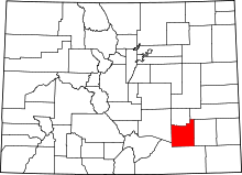 | |
| Towns | ||
| CDPs | ||
| Unincorporated communities | ||
| Ghost town | ||
This article is issued from
Wikipedia.
The text is licensed under Creative Commons - Attribution - Sharealike.
Additional terms may apply for the media files.