Tiksi Bay
| Tiksi Bay Бухта Тикси | |
|---|---|
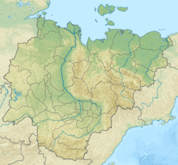 Tiksi Bay Map showing the location of Tiksi Bay | |
| Location | Far North |
| Coordinates | 71°39′N 129°8′E / 71.650°N 129.133°ECoordinates: 71°39′N 129°8′E / 71.650°N 129.133°E |
| River sources | Sogo River, Yuryage River |
| Ocean/sea sources | Laptev Sea |
| Basin countries | Russia |
| Max. length | 21 km (13 mi) |
| Max. width | 17 km (11 mi) |
| Average depth | 11 m (36 ft) |
| Settlements | Tiksi |
Tiksi Bay (Russian: Бухта Тикси, Bukhta Tiksi) is a bay of the Laptev Sea that cuts into the northern part of the Sakha Republic, Russia.
Geography
It is up to 21 km long, 17 km wide[1] and has a depth of 2 to 11 metres. The Sogo and Yuryage Rivers discharge into the bay.
The port of Tiksi lies on the west side.
Semidiurnal tides in the Kola Bay are about 0.3 metres. In winter the bay is clogged by ice.
References
- This article is based on a translation of the equivalent article of the Russian Wikipedia on 11 February 2009.
This article is issued from
Wikipedia.
The text is licensed under Creative Commons - Attribution - Sharealike.
Additional terms may apply for the media files.