Thruxton Aerodrome
| Thruxton Aerodrome | |||||||||||||||
|---|---|---|---|---|---|---|---|---|---|---|---|---|---|---|---|
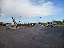 Entrance to airfield and racing circuit, 2009 | |||||||||||||||
| Summary | |||||||||||||||
| Airport type | Private | ||||||||||||||
| Operator | Western Air (Thruxton) Ltd | ||||||||||||||
| Location | Andover, Hampshire | ||||||||||||||
| Elevation AMSL | 319 ft / 97 m | ||||||||||||||
| Coordinates | 51°12′38″N 001°36′00″W / 51.21056°N 1.60000°WCoordinates: 51°12′38″N 001°36′00″W / 51.21056°N 1.60000°W | ||||||||||||||
| Map | |||||||||||||||
 EGHO Location in Hampshire | |||||||||||||||
| Runways | |||||||||||||||
| |||||||||||||||
Thruxton Aerodrome (ICAO: EGHO) is located in Thruxton, 4.5 NM (8.3 km; 5.2 mi) west of Andover, in Hampshire, England.
The airfield was opened in 1942 as RAF Thruxton. Postwar, it was reopened by the Wiltshire School of Flying in 1947,[2] and private and club flying operations continue to the present time.
Thruxton Aerodrome has a CAA Ordinary Licence (Number P544) that allows flights for the public transport of passengers or for flying instruction as authorised by the licensee, Western Air (Thruxton) Limited.[3]
Motorbike racing began on a track using the runways and perimeter roads in 1950. Thruxton Circuit, which follows the line of the perimeter road, has been used for motorbike and car racing since 1968.[4]
References
- ↑ Thruxton - EGHO
- ↑ "From the Clubs". Flight magazine. 29 January 1948. p. 122. Retrieved 22 July 2016.
- ↑ Civil Aviation Authority Aerodrome Ordinary Licences
- ↑ "Circuit Facilities - History of Thruxton". Thruxton Motorsport Centre. Retrieved 18 November 2016.
External links
![]()