Thorland
 Thorland | |
| Geography | |
|---|---|
| Location | Southeast Greenland |
| Coordinates | 63°34′N 41°30′W / 63.567°N 41.500°WCoordinates: 63°34′N 41°30′W / 63.567°N 41.500°W |
| Adjacent bodies of water |
Bernstorff Fjord Irminger Sea Northern Skjoldungen Fjord |
| Length | 47 km (29.2 mi) |
| Width | 29 km (18 mi) |
| Highest elevation | 1,915.9 m (6,285.8 ft) |
| Highest point | Ansbjerg |
| Administration | |
|
Greenland (Denmark) | |
| Municipality | Sermersooq |
| Demographics | |
| Population | 0 |
Thorland (Danish: Thors Land) is a peninsula in the King Frederick VI Coast, southeastern Greenland. It is a part of the Sermersooq municipality.
History
One of the coastal islands, Igdluluarssuk (Sattiaatteq) at the entrance of the fjord on its southern side, had had the northernmost Inuit settlement of the southern group on the east coast in the recent past.[1]
Arctic explorer Wilhelm August Graah of the Danish Navy explored this area in 1828–30, during an expedition in search of the legendary Eastern Norse Settlement and named this peninsula after Thor.[2]
Geography
Thorland is surrounded to the northeast by the Bernstorff Fjord —across which lies the Odinland Peninsula, to the east by the Irminger Sea and to the southwest by the Northern Skjoldungen Fjord. To the west and the northwest the peninsula is attached to the mainland. The southern part has a deeply indented coast dividing into three narrow arms jutting southeastwards with deep fjords between them, including the Graah Fjord, Jaette Fjord and Kangerdlikajik.[3] Several glaciers pour into the Bernstorff Fjord from the northern side of the peninsula, the most important of which are Storebjørn, Tjalfe Glacier and Røskva Glacier, while the Jomfruen in the west has its terminus in the Norrevig, an offshoot of the Northern Skjoldungen Fjord.[4]
There are several islands at the mouth of the fjords at the eastern end of the peninsula the largest of which are Tupikajik, Akorninarmiut, Imaarsivik, Kiasigssaq, Qiputalik, Nappat, Qeertartivaq and Igdluluarssuk (Sattiaatteq) where there are Paleo-Eskimo archaeological sites.[4]
Mountains
This desolate peninsula is a destination for mountain climbing owing to some of its sturdy granite walls and jagged peaks.[5] Its highest point is 1,916 m high Ansbjerg, a nunatak rising above the Norrevig in the SW at 63°34′35″N 41°40′5″W / 63.57639°N 41.66806°W. Other notable summits are Kokkefars Hat, a conspicuous 996 m high peak at 63°27′5″N 41°33′25″W / 63.45139°N 41.55694°W in the southernmost arm of the peninsula,[6] Hvidbræmmen, a 1,304 m high peak in the northern side of Thorland, Hvide Telt, Hakkefjeld, Hanekammen and Rypefjeldet.[7]
In Thorland there are several nunataks besides Ansbjerg, such as Akuliaruseq, Diabastoppen, Skønheden and Strudsen. Svartalfbjerg is a mountain on the west side of the Storebjørn Glacier.[4]
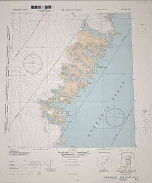 1944 map of the area around Skjoldungen with the Thorland Peninsula just north of the island. |
See also
References
- ↑ Encyclopedia Arctica 15: Biographies - Gustav Frederick Holm
- ↑ Graah, W. A. (1832). Undersøgelses-Reise til Østkysten af Grønland, efter kongelig Befaling udført i Aarene 1828-31 [Exploration of the East Coast of Greenland, by royal order executed in the years 1828-31] (in Danish). Copenhagen.
- ↑ Prostar Sailing Directions 2005 Greenland and Iceland Enroute, p. 102
- 1 2 3 "Thors Land". Mapcarta. Retrieved 5 May 2016.
- ↑ North America, East Greenland, Thor's Land, Queen Lilliana, First Ascent
- ↑ View of the Northern Skjoldungen Fjord with the Kokkefars Hat in the distance
- ↑ GoogleEarth