Thorens-Glières
| Thorens-Glières | |
|---|---|
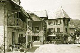 The village in 1969 | |
 Thorens-Glières Location within Auvergne-Rhône-Alpes region  Thorens-Glières | |
| Coordinates: 45°59′52″N 6°14′52″E / 45.9978°N 6.2478°ECoordinates: 45°59′52″N 6°14′52″E / 45.9978°N 6.2478°E | |
| Country | France |
| Region | Auvergne-Rhône-Alpes |
| Department | Haute-Savoie |
| Arrondissement | Annecy |
| Canton | Annecy-le-Vieux |
| Area1 | 63.05 km2 (24.34 sq mi) |
| Population (2014)2 | 3,163 |
| • Density | 50/km2 (130/sq mi) |
| Time zone | UTC+1 (CET) |
| • Summer (DST) | UTC+2 (CEST) |
| INSEE/Postal code | 74282 /74570 |
| Elevation | 565–2,004 m (1,854–6,575 ft) |
|
1 French Land Register data, which excludes lakes, ponds, glaciers > 1 km2 (0.386 sq mi or 247 acres) and river estuaries. 2 Population without double counting: residents of multiple communes (e.g., students and military personnel) only counted once. | |
Thorens-Glières is a former commune in the Haute-Savoie department in the Auvergne-Rhône-Alpes region in south-eastern France. On 1 January 2017, it was merged into the new commune Fillière.[1] It is the birthplace of St. Francis de Sales.
See also
References
- ↑ Arrêté préfectoral 27 May 2016 (in French)
| Wikimedia Commons has media related to Thorens-Glières. |
This article is issued from
Wikipedia.
The text is licensed under Creative Commons - Attribution - Sharealike.
Additional terms may apply for the media files.