Thong Saen Khan District
| Thong Saen Khan ทองแสนขัน | |
|---|---|
| District | |
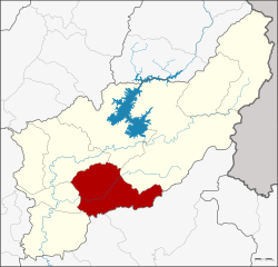 District location in Uttaradit Province | |
| Coordinates: 17°28′31″N 100°20′1″E / 17.47528°N 100.33361°ECoordinates: 17°28′31″N 100°20′1″E / 17.47528°N 100.33361°E | |
| Country | Thailand |
| Province | Uttaradit |
| Seat | Bo Thong |
| Area | |
| • Total | 745.4 km2 (287.8 sq mi) |
| Population (2005) | |
| • Total | 33,042 |
| • Density | 44.3/km2 (115/sq mi) |
| Time zone | UTC+7 (ICT) |
| Postal code | 53230 |
| Geocode | 5309 |
Thong Saen Khan (Thai: ทองแสนขัน, pronounced [tʰɔ̄ːŋ sɛ̌ːn kʰǎn]) is a district (amphoe) in the southern part of Uttaradit Province, northern Thailand.
Geography
Neighboring districts are (from the southwest clockwise) Phichai, Tron, Mueang Uttaradit, Tha Pla, Nam Pat of Uttaradit Province, Chat Trakan and Wat Bot of Phitsanulok Province
History
The minor district (king amphoe) was created on 1 July 1983, when four tambon were split off from Tron District.[1] It was upgraded to a full district on 21 May 1990.[2]
Administration
The district is divided into four sub-districts (tambons), which are further subdivided into 45 villages (muban). The township (thesaban tambon) Thong Saen Khan covers parts of tambon Bo Thong. There are a further four tambon administrative organizations (TAO).
| No. | Name | Thai name | Villages | Pop. | |
|---|---|---|---|---|---|
| 1. | Phak Khuang | ผักขวง | 14 | 9,198 | |
| 2. | Bo Thong | บ่อทอง | 14 | 12,287 | |
| 3. | Pa Khai | ป่าคาย | 9 | 6,030 | |
| 4. | Nam Phi | น้ำพี้ | 8 | 5,527 |
References
- ↑ ประกาศกระทรวงมหาดไทย เรื่อง แบ่งท้องที่อำเภอตรอน จังหวัดอุตรดิตถ์ ตั้งเป็นกิ่งอำเภอทองแสนขัน (PDF). Royal Gazette (in Thai). 100 (109 ง): 2134. July 5, 1983.
- ↑ พระราชกฤษฎีกาตั้งอำเภอห้วยผึ้ง อำเภอวังวิเศษ อำเภอคลองหาด อำเภอป่าบอน อำเภอหนองหญ้าปล้อง อำเภอวังโป่ง อำเภอควนเนียง อำเภอหนองหญ้าไซ อำเภอบ้านนาเดิม อำเภอทุ่งฝน อำเภอสร้างคอม และอำเภอทองแสนขัน พ.ศ. ๒๕๓๓ (PDF). Royal Gazette (in Thai). 107 (83 ก special): 1–4. May 21, 1990.
External links