Thirthahalli
| Thirthahalli | |
|---|---|
| Taluk | |
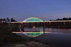 Tunga Bridge with Lightings during Theppotsava | |
 Thirthahalli Location in Karnataka, India | |
| Coordinates: 13°41′24″N 75°14′42″E / 13.690°N 75.245°ECoordinates: 13°41′24″N 75°14′42″E / 13.690°N 75.245°E | |
| Country |
|
| State | Karnataka |
| District | Shimoga |
| Region | Malenadu |
| Government | |
| • MLA | Araga Jnanendra |
| Area | |
| • Total | 5.91 km2 (2.28 sq mi) |
| Elevation566 | 591 m (1,939 ft) |
| Population (2011[1]) | |
| • Total | 14,357 |
| • Density | 2,400/km2 (6,300/sq mi) |
| Languages | |
| • Official | Kannada |
| Languages | |
| Time zone | UTC+5:30 (IST) |
| PIN | 577 432 |
| Telephone code | 08181 |
| Vehicle registration | KA-14 |
| Website |
www |
Thirthahalli is a panchayat town located in the Shimoga District of the state of Karnataka, India. It lies on the bank of the river Tunga and is also the headquarters of the Thirthahalli Taluk of Shimoga district. Nearest Railway stations are Anandpura (55 Km), Shivamogga (62 Km) and Bhadravathi (68 km).
Geography
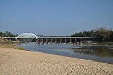
Bridge across the river Tunga at Thirthahalli
Thirthahalli is located at 13°42′N 75°14′E / 13.7°N 75.23°E.[2] It has an average elevation of 591 metres (1938 feet). it is located in the midst of the dense forests of the Western Ghats.
Notable people
- Kuvempu
- Shantaveri Gopala Gowda - Socialist Leader and Politician
- U. R. Ananthamurthy
- Kimmane Rathnakar
- M. K. Indira, Kannada Novelist.
- Poornachandra Tejaswi
- Girish Kasaravalli, Kannada Film Director.
- Kadidal Manjappa, former Chief Minister of Karnataka
- Justice. M Rama Jois - Judge
Schools
References
External links
| Wikimedia Commons has media related to Thirthahalli. |
This article is issued from
Wikipedia.
The text is licensed under Creative Commons - Attribution - Sharealike.
Additional terms may apply for the media files.