Tirurangadi
| Tirurangadi | |
|---|---|
| town | |
.jpg) Tirurangadi Orphanage | |
| Coordinates: 11°03′N 75°56′E / 11.05°N 75.93°ECoordinates: 11°03′N 75°56′E / 11.05°N 75.93°E | |
| Country |
|
| State | Kerala |
| District | Malappuram |
| Elevation | 10 m (30 ft) |
| Languages | |
| • Official | Malayalam, English |
| Time zone | UTC+5:30 (IST) |
| Vehicle registration | KL-65 |
.jpg)
Tirurangadi is a municipal and census town in Malapuram district of Kerala, South India. It is a historical town which is famed for its active participation in the freedom struggle, especially those dating back to 1920s. It is a Municipality and a taluk. It is located 25 km west of Malappuram, the district headquarters, 30 km south of Calicut and 140 km north of Ernakulam.
Geography
Tirurangadi is located at 11°03′N 75°56′E / 11.05°N 75.93°E.[1][2] It has an average elevation of 10 m (33 ft).
Religion
Total population: 56,700 Hindu: 14.39% Muslim: 85.24% Christian: 0.23% Sikh: 0.00% Buddhist: 0.00% Jain: 0.00% Others: 0.00% Not Stated: 0.14%[3]
Transport
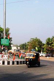
This town is well connected with all parts of Kerala and National Highway 66 (India), (Old number NH17) passes through this town. There are two main bus stations situated in the town, one in Chemmad, and another one in Kakkad. The former is for buses plying to the nearby areas while the latter is used for long distance buses only.
The nearest railway station is at Parappanangadi, 7 km away from the town and Calicut International Airport is just 21 km away.
The famous house of Ayurveda Kottakkal Aryavaidyasala is just 10 km away from Tirurangadi.
Education
Tirurangadi, a well-versed place in the history of Freedom Fight is now known as a small educational hub in Malappuram district. The PSMO College is in the centre of the town surrounded by several other institutions. Headquarters of University of Calicut is just 13 km away.
Colleges and schools
- Tirurangadi Government Higher Secondary School and Oriental Higher Secondary School are the two important schools serving the primary educational needs of the area and nearby areas
- "Thirurangadi yatheem khana" is a well noted institution among its kind having numerous institutions under its hood, including PSMO College, KMMMO Arabic College, SSMO Teachers Training Institute, Oriental Higher Secondary School, MKH Memorial Hospital, MKH Nursing College.
- Darul Huda Islamic University, Chemmad, Tirurangadi
- Pocker Sahib Memorial Orphanage College (PSMO College), Tirurangadi
- KMMO Arabic College, Tirurangadi
- Govt. Poly Technic, Chelari, Tirurangadi
- SSMO Teachers Training Institute, Tirurangadi
- Govt. Higher Secondary School, Tirurangadi
- Oriental Higher Secondary School, Tirurangadi
- Govt. High School, Trikkulam, Tirurangadi
- Khuthubuzzaman English Medium Higher Secondary School, Chemmad, Tirurangadi
- MKH School of Nursing, Tirurangadi
- Gems Public School (Affiliated to CBSE, Delhi), Kooriyad, PO Tirurangadi
- Kerala Residentail Higher Secondary School, Karumbil, Tirurangadi
- National English Medium Higher Secondary School, Chemmad, Tirurangadi
- Malabar Central School, Valiya Paramabu, Tirurangadi
Places of interest

- Tirurangadi Big Mosque: The Tirurangadi Big Mosque is a famous mosque located in Tirurangadi in the Malappuram District of Kerala, south India. Historically related to the Mappila Lahala of 1921 against the British Government
- Mambaram Masjidh: Mamburam Mosque is famous for the tomb of Sayyid Alavi Mouladaveel Sayyid Alavi Thangal, a Yemeni Islamic scholar and Indian freedom fighter who settled at Mamburam in Kerala is now considered as one of greatest pilgrimage centres in southern India.
Politics
Tirurangadi assembly constituency is part of Ponnani (Lok Sabha constituency).[4]
Tirurangadi is a Vidhan Sabha (Legislative Assembly) constituency of the State of Kerala.
Villages in Tirurangadi
- Tirurangadi
- Nannambra
- Parappangadi
- Edaricode
- Thennala
- Perumanna Klari
See also
References
- ↑ "Maps, Weather, and Airports for Tirurangadi, India". www.fallingrain.com.
- ↑ - Tirurangadi Archived 2011-08-01 at the Wayback Machine.
- ↑ "Tirurangadi City Population Census 2011 - Kerala". www.census2011.co.in.
- ↑ "Assembly Constituencies - Corresponding Districts and Parliamentary Constituencies" (PDF). Kerala. Election Commission of India. Archived from the original (PDF) on 2009-03-04. Retrieved 2008-10-19.
External links
| Wikimedia Commons has media related to Tirurangadi. |