Thevray
| Thevray | |
|---|---|
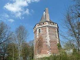 Chateau | |
 Thevray Location within Normandy region  Thevray | |
| Coordinates: 48°58′42″N 0°43′54″E / 48.9783°N 0.7317°ECoordinates: 48°58′42″N 0°43′54″E / 48.9783°N 0.7317°E | |
| Country | France |
| Region | Normandy |
| Department | Eure |
| Arrondissement | Bernay |
| Canton | Bernay |
| Government | |
| • Mayor (2008–2014) | Danièle Petit |
| Area1 | 14.9 km2 (5.8 sq mi) |
| Population (2008)2 | 280 |
| • Density | 19/km2 (49/sq mi) |
| Time zone | UTC+1 (CET) |
| • Summer (DST) | UTC+2 (CEST) |
| INSEE/Postal code | 27628 /27410 |
| Elevation |
133–188 m (436–617 ft) (avg. 171 m or 561 ft) |
|
1 French Land Register data, which excludes lakes, ponds, glaciers > 1 km2 (0.386 sq mi or 247 acres) and river estuaries. 2 Population without double counting: residents of multiple communes (e.g., students and military personnel) only counted once. | |
Thevray is a former commune in the Eure department in Normandy in northern France. On 1 January 2016, it was merged into the new commune of Mesnil-en-Ouche.[1]
Population
| Historical population | ||
|---|---|---|
| Year | Pop. | ±% |
| 1962 | 268 | — |
| 1968 | 284 | +6.0% |
| 1975 | 196 | −31.0% |
| 1982 | 168 | −14.3% |
| 1990 | 168 | +0.0% |
| 1999 | 175 | +4.2% |
| 2008 | 280 | +60.0% |
See also
References
- ↑ Arrêté préfectoral 9 December 2015 (in French)
| Wikimedia Commons has media related to Thevray. |
This article is issued from
Wikipedia.
The text is licensed under Creative Commons - Attribution - Sharealike.
Additional terms may apply for the media files.