The Thumb (mountain)
- This article is for the unofficially named mountain near Vancouver, British Columbia. For the officially named mountain in the Omineca region of British Columbia, see The Thumb (Omineca). For other uses see Thumb (disambiguation).
| The Thumb | |
|---|---|
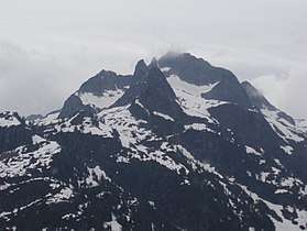 The thumb is on the spur ridge on the left of this photo. | |
| Highest point | |
| Elevation | 1,815 m (5,955 ft) |
| Prominence | 30 m (98 ft) |
| Coordinates | 49°30′51.8″N 122°42′5″W / 49.514389°N 122.70139°WCoordinates: 49°30′51.8″N 122°42′5″W / 49.514389°N 122.70139°W |
| Geography | |
| Location | British Columbia, Canada |
| Parent range | Five Fingers Group, Pacific Ranges, Coast Mountains |
| Topo map | NTS 92.G/10 |
| Climbing | |
| First ascent | 1940 R. Fraser; W. Mathews[1][2] |
| Easiest route | scramble from southeast[2] |
The Thumb is a mountain in the Five Fingers Group, a group of summits on the divide between Pitt Lake and Coquitlam Lake and north of Widgeon Lake, in British Columbia, Canada.[2][3]
Notes
References
- Fairley, Bruce (1986). A Guide to Climbing and Hiking in Southwestern British Columbia. Gordon Soules Book Publishers Ltd. ISBN 0-919574-99-8.
- "The Thumb". Bivouac.com. Retrieved 2007-02-18.
- "Five Fingers Group". Canadian Mountain Encyclopedia. Bivouac.com. Retrieved 2007-02-18.
This article is issued from
Wikipedia.
The text is licensed under Creative Commons - Attribution - Sharealike.
Additional terms may apply for the media files.