The Gap, Northern Territory
| The Gap Alice Springs, Northern Territory | |
|---|---|
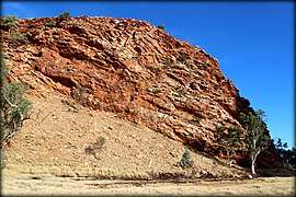 Rock formation at the Gap | |
|
The Gap | |
| Coordinates | 23°42′49″S 133°52′27″E / 23.71361°S 133.87417°ECoordinates: 23°42′49″S 133°52′27″E / 23.71361°S 133.87417°E |
| Population | 1,709 (2016)[1] |
| Postcode(s) | 0870 |
| LGA(s) | Town of Alice Springs |
| Territory electorate(s) | Araluen |
| Federal Division(s) | Lingiari |
The Gap is a suburb of the town of Alice Springs, in the Northern Territory, Australia.
References
- ↑ Australian Bureau of Statistics (27 June 2017). "The Gap (NT)". 2016 Census QuickStats. Retrieved 25 September 2017.

This article is issued from
Wikipedia.
The text is licensed under Creative Commons - Attribution - Sharealike.
Additional terms may apply for the media files.