Texas State Highway Spur 729
| ||||
|---|---|---|---|---|
| Route information | ||||
| Maintained by TxDOT | ||||
| Length | 0.2 mi[1][2] (0.3 km) | |||
| Existed | 2007–present | |||
| Major junctions | ||||
| West end | Feedlot Rd. / Burnett Rd. (dead end) | |||
| East end |
| |||
| Highway system | ||||
| ||||

Spur 729 is an approximately 0.2-mile (0.32 km) state highway spur in King County, Texas.[1] As of 2013, it was the highest numbered spur route in the Texas state highway system, until the completion of Spur 1966.[3]
Route description
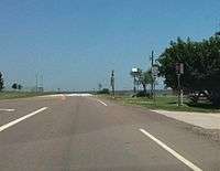
Spur 729 has an eastern terminus at an at-grade intersection with US 83 near the buildings of the Guthrie Common School District. The short route travels to the west along 6th Street, ending at a barricaded dead end.[4]
History
Spur 729 was designated on July 26, 2007 after TxDOT rerouted US 82 / SH 114 around Guthrie. Originally, US 82 entered Guthrie from the west and was duplexed with US 83 southbound for approximately one mile before the two routes separated past the South Wichita River bridge. The concurrency was eliminated with the construction of the US 82 bypass to the west of Guthrie and the upgrading of the southern intersection of the two highways to an interchange. Spur 729 is a section of the former US 82 into Guthrie, while the remaining portion of the former route was deleted from the state highway system.[1][5]
Previously, the roadway extended beyond the current western terminus and functioned as a ramp to westbound US 82; this ramp was eventually obliterated, as originally proposed by TxDOT to AASHTO, though its footprint is still visible past the barricades and fencing.[6]
Major intersections
The entire route is in Guthrie, King County.
| mi[2] | km | Destinations | Notes | ||
|---|---|---|---|---|---|
| 0.0 | 0.0 | Feedlot Rd. / Burnett Rd. | Western terminus | ||
| 0.2 | 0.32 | Eastern terminus | |||
| 1.000 mi = 1.609 km; 1.000 km = 0.621 mi | |||||
References
- 1 2 3 Transportation Planning and Programming Division (n.d.). "State Highway Spur No. 729". Highway Designation Files. Texas Department of Transportation. Retrieved April 18, 2011.
- 1 2 Google (April 18, 2011). "Overview map of Texas State Highway Spur 729 Distances Between Interchanges" (Map). Google Maps. Google. Retrieved April 18, 2011.
- ↑ Transportation Planning and Programming Division (n.d.). "State Highway Spur No. 1966". Highway Designation Files. Texas Department of Transportation. Retrieved August 31, 2013.
- ↑ Transportation Planning and Programming Division (2014). Texas County Mapbook (PDF) (Map) (2014 ed.). 1:120,000. Texas Department of Transportation. p. 207. Retrieved December 4, 2014.
- ↑ Texas Transportation Commission. "Minute Order #111016" (PDF). Retrieved April 18, 2011.
- ↑ "Application from TxDOT to AASHTO" (PDF). August 27, 2007. Archived from the original (PDF) on February 2, 2014. Retrieved January 24, 2014.