Texas State Highway 93
| ||||
|---|---|---|---|---|
 | ||||
| Route information | ||||
| Maintained by TxDOT | ||||
| Length | 6.478 mi[1] (10.425 km) | |||
| Existed | August 31, 1967[1]–present | |||
| Major junctions | ||||
| South end |
| |||
|
| ||||
| North end |
| |||
| Highway system | ||||
| ||||

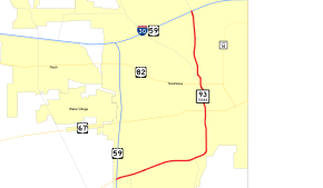
State Highway 93 (SH 93) is a numbered state highway in Texas. It covers a total of 6.478 miles (10.425 km), entirely within the city limits of Texarkana. This route was designated on August 31, 1967, when Summerhill Road was extended along the former Chance Street to an intersection with New Boston Road (U.S. Highway 82). It went from I‑30 to US 67 at the time. The route was later extended along Lucas Street to connect with Lake Drive at 10th Street, replacing a portion of Loop 151.
Route description
SH 93 includes the portion of Summerhill Road south of Interstate 30. It crosses New Boston Road, Martin Luther King Boulevard (westbound U.S. Highway 67), and 7th Street (eastbound US 67), after which it becomes Lake Drive. From there it forms a curve to the southwest and west, finally ending at Loop 151, and feeding into Interstate 369/U.S. Highway 59.
History
The original SH 93 was designated on January 21, 1924, as the route from Gatesville to the "state reformatory school", which was the state juvenile training and rehabilitation school for boys, a few miles north.[2] On July 25, 1933, this route became a portion of SH 36 (yet SH 93 is still on the 1935 map).[3][4]
Junction list
The entire route is in Texarkana, Bowie County.
| mi[5] | km | Destinations | Notes | ||
|---|---|---|---|---|---|
| 0.0 | 0.0 | ||||
| 3.5 | 5.6 | One way street | |||
| 3.6 | 5.8 | One way street | |||
| 4.4 | 7.1 | ||||
| 4.8 | 7.7 | ||||
| 6.5 | 10.5 | I‑30 exit 222 | |||
| 1.000 mi = 1.609 km; 1.000 km = 0.621 mi | |||||
References
- 1 2 Transportation Planning and Programming Division (n.d.). "State Highway No. 93". Highway Designation Files. Texas Department of Transportation. Retrieved December 9, 2016.
- ↑ (PDF) https://publicdocs.txdot.gov/minord/MinuteOrderDocLib/003676883.pdf. Missing or empty
|title=(help) - ↑ (PDF) https://publicdocs.txdot.gov/minord/MinuteOrderDocLib/003673832.pdf. Missing or empty
|title=(help) - ↑ Transportation Planning and Programming Division (n.d.). "State Highway No. 36". Highway Designation Files. Texas Department of Transportation. Retrieved December 9, 2016.
- ↑ Google (December 9, 2016). "Overview Map of SH 93" (Map). Google Maps. Google. Retrieved December 9, 2016.