Texas State Highway 136
| ||||
|---|---|---|---|---|
 | ||||
| Route information | ||||
| Maintained by TxDOT | ||||
| Length | 108.58 mi[1] (174.74 km) | |||
| Existed | 1929–present | |||
| Major junctions | ||||
| North end |
| |||
| South end |
| |||
| Highway system | ||||
| ||||

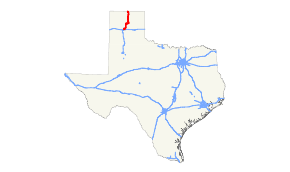
State Highway 136 or SH 136 is a Texas state highway that runs from the Texas–Oklahoma border south of Guymon, Oklahoma to Amarillo. The route was designated on February 20, 1929 from Amarillo to Oklahoma.[2]On October 21, 1929, the route was truncated to Stinnett.[3] On February 4, 1941, the section of SH 136 from the Moore/Potter County Line to Stinnett was cancelled. In 1942, the route was extended east to Borger. The highway was extended to the Oklahoma border on November 21, 1963, replacing part of FM 278 and all of FM 2216.
Junction list
| County | Location | mi[4] | km | Destinations | Notes | |||
|---|---|---|---|---|---|---|---|---|
| Potter | Amarillo | 0.0 | 0.0 | Southern terminus | ||||
| Mayer | 3.5 | 5.6 | Interchange | |||||
| 4.1 | 6.6 | |||||||
| | 9.8 | 15.8 | ||||||
| | 12.2 | 19.6 | ||||||
| | 16.2 | 26.1 | ||||||
| Moore |
No major junctions | |||||||
| Hutchinson | | 35.8 | 57.6 | |||||
| | 41.2 | 66.3 | ||||||
| Borger | 42.6 | 68.6 | ||||||
| 43.6 | 70.2 | Interchange | ||||||
| 45.4 | 73.1 | Southern terminus of SH 207 concurrency | ||||||
| 46.0 | 74.0 | Southern terminus of SH 152 concurrency | ||||||
| 46.6 | 75.0 | Western terminus of Spur 119 | ||||||
| 47.4 | 76.3 | Roundabout, western terminus of Spur 245 and Spur 140 | ||||||
| 47.8 | 76.9 | |||||||
| | 49.5 | 79.7 | ||||||
| | 55.4 | 89.2 | ||||||
| Stinnett | 57.1 | 91.9 | Northern terminus of SH 152 concurrency | |||||
| | 64.1 | 103.2 | Northern terminus of SH 207 concurrency | |||||
| Pringle | 66.7 | 107.3 | ||||||
| | 71.8 | 115.6 | ||||||
| Hansford | | 74.5 | 119.9 | |||||
| | 79.4 | 127.8 | ||||||
| | 85.5 | 137.6 | ||||||
| Gruver | 90.1 | 145.0 | Eastern terminus of SH 15 concurrency | |||||
| 90.1 | 145.0 | |||||||
| 90.2 | 145.2 | Western terminus of SH 15 concurrency | ||||||
| | 96.3 | 155.0 | ||||||
| Texas–Oklahoma state line | 108.6 | 174.8 | ||||||
1.000 mi = 1.609 km; 1.000 km = 0.621 mi
| ||||||||
References
- ↑ Transportation Planning and Programming Division (n.d.). "State Highway No. 136". Highway Designation Files. Texas Department of Transportation. Retrieved 2010-06-15.
- ↑ (PDF) https://publicdocs.txdot.gov/minord/MinuteOrderDocLib/003673779.pdf. Missing or empty
|title=(help) - ↑ (PDF) https://publicdocs.txdot.gov/minord/MinuteOrderDocLib/003673787.pdf. Missing or empty
|title=(help) - ↑ Google (March 6, 2013). "Texas State Highway 136" (Map). Google Maps. Google. Retrieved March 6, 2013.
Google (March 6, 2013). "Texas State Highway 136" (Map). Google Maps. Google. Retrieved March 6, 2013.
Google (March 6, 2013). "Texas State Highway 136" (Map). Google Maps. Google. Retrieved March 6, 2013.
This article is issued from
Wikipedia.
The text is licensed under Creative Commons - Attribution - Sharealike.
Additional terms may apply for the media files.