Ter, Ljubno
| Ter | |
|---|---|
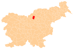
 Ter Location in Slovenia | |
| Coordinates: 46°21′3.48″N 14°50′21.93″E / 46.3509667°N 14.8394250°ECoordinates: 46°21′3.48″N 14°50′21.93″E / 46.3509667°N 14.8394250°E | |
| Country |
|
| Traditional region | Styria |
| Statistical region | Savinja |
| Municipality | Ljubno |
| Area | |
| • Total | 23.18 km2 (8.95 sq mi) |
| Elevation | 518.6 m (1,701.4 ft) |
| Population (2002) | |
| • Total | 230 |
| [1] | |
Ter (pronounced [ˈtɛːɾ], German: Thörberg[2]) is a dispersed settlement in the hills northeast of Ljubno ob Savinji in Slovenia. Traditionally the area belonged to the region of Styria and it is now included in the Savinja Statistical Region.[3]
References
- ↑ Statistical Office of the Republic of Slovenia
- ↑ Leksikon občin kraljestev in dežel zastopanih v državnem zboru, vol. 4: Štajersko. 1904. Vienna: C. Kr. Dvorna in Državna Tiskarna, p. 44.
- ↑ Ljubno municipal site
External links
| Settlements | Administrative centre: Ljubno ob Savinji
|  |
|---|---|---|
| Landmarks |
| |
This article is issued from
Wikipedia.
The text is licensed under Creative Commons - Attribution - Sharealike.
Additional terms may apply for the media files.