Tennyson, Texas
| Tennyson, Texas | |
|---|---|
| Unincorporated community | |
 Tennyson Location within the state of Texas  Tennyson Tennyson (the US) | |
| Coordinates: 31°44′31″N 100°17′10″W / 31.74194°N 100.28611°WCoordinates: 31°44′31″N 100°17′10″W / 31.74194°N 100.28611°W | |
| Country | United States |
| State | Texas |
| County | Coke |
| Elevation | 1,883 ft (574 m) |
| Time zone | UTC-6 (Central (CST)) |
| • Summer (DST) | UTC-5 (CDT) |
| ZIP codes | 76953 |
| GNIS feature ID | 1348370 |
Tennyson is an unincorporated community in southeastern Coke County, Texas, United States. It lies along U.S. Route 277 southeast of the city of Robert Lee, the county seat of Coke County.[1] Its elevation is 1,883 feet (574 m).[2] Although Tennyson is unincorporated, it has a post office, with the ZIP code of 76953;[3] the ZCTA for ZIP code 76953 had a population of 64 at the 2000 census.[4]
Named for Alfred, Lord Tennyson by an English settler who arrived in 1882, the community received a post office in 1892. Tennyson began to grow after the Kansas City, Mexico and Orient Railway was built through the area in 1910, but it began to shrink when its local cotton farming economy shrank in the 1920s.[5]
References
- ↑ Rand McNally. The Road Atlas '08. Chicago: Rand McNally, 2008, p. 99.
- ↑ U.S. Geological Survey Geographic Names Information System: Tennyson, Texas
- ↑ Zip Code Lookup
- ↑ "American FactFinder". United States Census Bureau. Retrieved 2008-01-31.
- ↑ Tennyson, Texas, Handbook of Texas Online, 2008-01-18. Accessed 2008-08-13.
External links
Municipalities and communities of Coke County, Texas, United States | ||
|---|---|---|
| Cities | 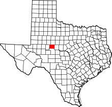 | |
| Town | ||
| Unincorporated communities | ||
| Ghost towns | ||
| Footnotes | ‡This populated place also has portions in an adjacent county or counties | |
This article is issued from
Wikipedia.
The text is licensed under Creative Commons - Attribution - Sharealike.
Additional terms may apply for the media files.