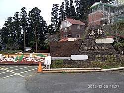
Tengjhih National Forest Recreation Area
Coordinates: 23°4′4.5″N 120°45′16.2″E / 23.067917°N 120.754500°E
| Tengjhih National Forest Recreation Area Chinese: 藤枝國家森林遊樂區 | |
|---|---|
 | |
| Geography | |
| Location | Taoyuan, Kaohsiung, Taiwan |
| Elevation | 500-1,804 meters |
| Area | 770 hectares |
The Tengjhih National Forest Recreation Area (Chinese: 藤枝國家森林遊樂區; pinyin: Téngzhī Guójiā Sēnlín Yóulè Qū) is a forest in Baoshan Village, Taoyuan District, Kaohsiung, Taiwan.
Administration
The forest is administered by the 70th, 71st and 72nd offices of the Forest Administration Agency.[1]
Geography
The forests spreads over an area of 770 hectares with height ranges from 500 to 1,804 meters. The mean average temperature inside the forest is 18-21ºC.[2]
Vegetation
The forests consists of Chinese firs, maples, cherry trees, plum trees etc.[3]
Activities
Various activities can be done in the forest, such as jungle trekking, hiking, mount climbing, bird watching etc.[4]
Facilities
The forest is equipped with log cabins, watchtower, meteorology station and alarm.[4]
Opening time
The forest is open everyday from 8:00 a.m. to 5:00 p.m.[5]
References
- ↑ "Tengjhi National Forest Recreation Area". Taoyuan District Office, Kaohsiung City. Retrieved 19 April 2018.
- ↑ "Tengjhih Forest Recreation Area". National Forest Recreation. Retrieved 16 December 2016.
- ↑ "Tengjhih National Forest Recreation Area". Travel King. Retrieved 16 December 2016.
- 1 2 Yolanda. "Tengzhi National Forest Recreation Area". Maolin National Scenic Area. Retrieved 16 December 2016.
- ↑ "Tengjhih National Forest Recreation Area". Taiwan The Heart of Asia. Retrieved 16 December 2016.
| Wikimedia Commons has media related to Tengjhih National Forest Recreation Area. |