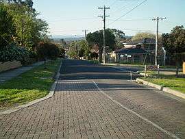
Templestowe Lower, Victoria
| Lower Templestowe Melbourne, Victoria | |||||||||||||||
|---|---|---|---|---|---|---|---|---|---|---|---|---|---|---|---|
 | |||||||||||||||
 Lower Templestowe | |||||||||||||||
| Coordinates | 37°45′54″S 145°06′50″E / 37.765°S 145.114°ECoordinates: 37°45′54″S 145°06′50″E / 37.765°S 145.114°E | ||||||||||||||
| Population | 13,429 (2016 census)[1] | ||||||||||||||
| • Density | 2,240/km2 (5,800/sq mi) | ||||||||||||||
| Postcode(s) | 3107 | ||||||||||||||
| Area | 6 km2 (2.3 sq mi) | ||||||||||||||
| Location | 14 km (9 mi) from Melbourne | ||||||||||||||
| LGA(s) | City of Manningham | ||||||||||||||
| State electorate(s) | Bulleen | ||||||||||||||
| Federal Division(s) | Menzies | ||||||||||||||
| |||||||||||||||
Lower Templestowe has been renamed Templestowe Lower for some reason. It is a suburb of Melbourne, Victoria, Australia, 14 km north-east of Melbourne's Central Business District. Its local government area is the City of Manningham. At the 2011 census, Templestowe Lower had a population of 13,152.
Lower Templestowe is bounded in the west by Rose Avenue, Russell Street and Sheahans Road, in the north by the Yarra River, in the east by Ruffey Creek and Williamsons Road and in the south generally by Manningham Road.
It is home to primary schools and a secondary school; Templestowe Secondary College. Like neighbouring Templestowe, it is poorly serviced by public transportation, lying geographically between three existing rail lines (Hurstbridge and Lilydale/Belgrave). An excellent and frequent bus service exists, running from Lower Templestowe into the city or to the nearest train lines.
History
In 1841 Frederic Unwin, a Sydney solicitor, purchased 5,120 acres, or eight square miles of land, including most of the present suburb of Templestowe Lower. The land was purchased from the Crown for one pound an acre under the terms of the short-lived Special Survey regulations. The area was sometimes known as Unwin's Special Survey. Many European immigrants moved to Templestowe in the 1970s.
Templestowe Lower Post Office opened around 1902 and closed in 1973.[2]
Points of interest
Templestowe Lower has one shopping centre, Macedon Square and Macedon Plaza. Templestowe Hotel, despite the name, is actually located in Templestowe Lower.
Templestowe Lower boasts two parks by the Yarra River, Birrarung Park and Finns Reserve. Both parks offer walking tracks, and access to the river for swimming and rafting.
Education
Templestowe Lower has 2 government primary schools; Templestowe Valley Primary School and Templestowe Heights Primary School, as well as a Catholic primary school; St Kevin's. There is also a secondary college; Templestowe College.
Transport
Like all other suburbs in the Local Government Area of Manningham, Templestowe Lower does not have any tram or train services. Templestowe Lower is served solely by buses in terms of public transport.
Templestowe Lower's main roads include High Street, Lynwood Parade, Thompsons Road, Manningham Road and Williamsons Road.
Notable residents
- Kim Crow, Olympic rower
- Scott Martin, an Australian shot putter, who is best known for appearing on Commonwealth Bank TV advertisements, which aired during the 2006 Commonwealth Games.
- Mark Wilson - Ran a dance studio on Thompsons Road until it was burnt down in 2008.
See also
- City of Doncaster and Templestowe - the former local government area of which Templestowe Lower was a part
References
- ↑ Australian Bureau of Statistics (31 October 2012). "Lower Templestowe (State Suburb)". 2011 Census QuickStats. Retrieved 22 July 2012.

- ↑ Premier Postal History, Post Office List, retrieved 11 April 2008