Telegraph Peak (California)
| Telegraph Peak | |
|---|---|
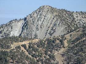 Telegraph Peak as seen from Devils Backbone ridge on Mount San Antonio. | |
| Highest point | |
| Elevation | 8,989 ft (2,740 m) NAVD 88[1] |
| Prominence | 1,183 ft (361 m) [1] |
| Parent peak | Mount San Antonio[2] |
| Listing | Hundred Peaks Section[3] |
| Coordinates | 34°15′41″N 117°35′53″W / 34.2613942°N 117.5981093°WCoordinates: 34°15′41″N 117°35′53″W / 34.2613942°N 117.5981093°W [4] |
| Geography | |
| Location | San Bernardino County, California, U.S. |
| Parent range | San Gabriel Mountains |
| Topo map | USGS Telegraph Peak |
| Climbing | |
| Easiest route | Hike, class 1[3] |
Telegraph Peak, is a peak of the San Gabriel Mountains, in the San Gabriel Mountains National Monument and San Bernardino County, California.
With an elevation of 8,989 feet (2,740 m), it is highest point in the Cucamonga Wilderness of the San Bernardino National Forest.[1]
See also
- San Gabriel Mountains National Monument−related topics
References
- 1 2 3 "Telegraph Peak, California". Peakbagger.com. Retrieved 2012-04-01.
- ↑ "Telegraph Peak". ListsOfJohn.com. Retrieved 2012-04-01.
- 1 2 "Telegraph Peak". Hundred Peaks Section List. Angeles Chapter, Sierra Club. Retrieved 2009-08-24.
- ↑ "Telegraph Peak". Geographic Names Information System. United States Geological Survey. Retrieved 2007-08-15.
This article is issued from
Wikipedia.
The text is licensed under Creative Commons - Attribution - Sharealike.
Additional terms may apply for the media files.