Taz River
Coordinates: 67°34′00″N 78°51′00″E / 67.5667°N 78.85°E
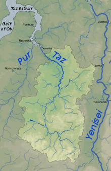
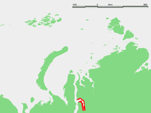
The Taz (Russian: Таз) is a river located in western Siberia, has a length of 1,401 kilometers (871 mi) and drains a basin estimated at 150,000 square kilometers (58,000 sq mi).
The Taz River flows into the Tazovskaya Guba, a roughly 250-kilometer (160 mi) long estuary that begins in the area of the settlement of Tazovsky and ends in the Gulf of Ob. A portage connects the Taz with the Turukhan and the Yenisei Rivers. Its major tributaries include the Bolshaya Shirta and Khudosey Rivers from the right and the Tolka and Chaselka Rivers from the left.
The now ruined city of Mangazeya was located by the Taz River. Its estuary and lower course are located within Yamalo-Nenets Autonomous Okrug, while its upper course borders with Krasnoyarsk Krai.
External links
- Flooding:
- Pictures taken by Landsat satellites showing areas in western Siberia allegedly changing due to global warming: .
- Ethnographic data of the Taz River area:
- Bears in the Taz River area: