Tauernkogel (Venediger Group)
| Tauernkogel | |
|---|---|
 | |
| Highest point | |
| Elevation | 2,988 m (AA) (9,803 ft) |
| Prominence | 359 m ↓ Dichtenscharte |
| Isolation | 3.2 km → Rote Säule |
| Coordinates | 47°09′28″N 12°29′01″E / 47.15778°N 12.48361°ECoordinates: 47°09′28″N 12°29′01″E / 47.15778°N 12.48361°E |
| Geography | |
| Parent range | Venediger Group |
| Climbing | |
| Normal route | East arête (I) |

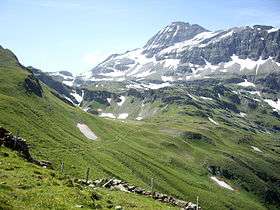
The Tauernkogel (also Felber Tauernkogel) is a mountain, 2,988 m (AA), in the Venediger Group of Austria's High Tauern. It lies west of the Felber Tauern and the border between the states of Salzburg and Tyrol runs over the summit. It may be climbed on a difficult mountain tour via a steep snowfield in about 1.½ hours from the St. Pöltner Hut.[1]
References
Sources
- Österreichische Karte (ÖK) des Bundesamtes für Eich- und Vermessungswesen (BEV).
- Alpine Club map: Venedigergruppe, German Alpine Club.
This article is issued from
Wikipedia.
The text is licensed under Creative Commons - Attribution - Sharealike.
Additional terms may apply for the media files.