Taromske
| Taromske Таромське | |
|---|---|
| Former urban-type settlement | |
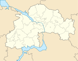 Taromske Location of Taromske in Dnipropetrovsk Oblast | |
| Coordinates: 48°27′42″N 34°46′58″E / 48.46167°N 34.78278°ECoordinates: 48°27′42″N 34°46′58″E / 48.46167°N 34.78278°E | |
| Country |
|
| Municipality | Dnipro Municipality |
| Urban district | Novokodatskyi District |
| Settlement status | 1938 |
| Liquidated | September 2001 |
| Area | |
| • Total | 75 km2 (29 sq mi) |
| Population (2005) | |
| • Total | 15,500 |
| • Density | 210/km2 (540/sq mi) |
| Time zone | UTC+2 (EET) |
| • Summer (DST) | UTC+3 (EEST) |
| Postal code | 69061 |
| Area code | +380 61 |
Taromske (Ukrainian: Таромське, Russian: Таромское) was an urban-type settlement (and constituent unit of its own settlement council) of the Novokodatskyi District (urban district) of the Dnipro Municipality in southern Ukraine. Its population was 15,500 in 2005.
History
The location of Taromske is known since 1190 as Tarrentsky Rig (Ukrainian language "Tarrent Horn").
It was settletled by Zaporizhian Cossacks at least since 1564. In 1704 Taromske became a town in Kodak Palanka of Zaporizhian Sich.
In 1764 Taromske was granted a State military status as citizens were free people that had to military serve Russian Tzar.
In 1885, the populated settlement of Taromske was a village. In 1938, it was given the status of an urban-type settlement. Since 1970, the settlement was included into the boundaries of Dniproperovsk.
From 1992–2001, the settlement was an autonomous settlement that was subordinate to the Dnipropetrovsk Municipality. In September 2001, its status of an urban-type settlement was liquidated and it was absorbed into the city's Leninskyi District. On 26 November 2015 Leninskyi District (named after Vladimir Lenin) was renamed to Novokodatskyi District to comply with decommunization laws.[1]
| Districts | |||||
|---|---|---|---|---|---|
| Cities | |||||
| Urban-type settlements | |||||
| Neighborhoods |
| ||||
| |||||
- ↑ (in Ukrainian) Street signs were Dnipropetrovsk nedekomunizovanymy, Radio Svoboda (2 December 2015)