Tara County

Tara
New South Wales
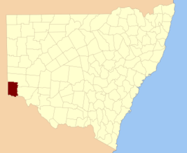
Location in New South Wales
Lands administrative divisions around Tara:
Hamley (SA) Windeyer Windeyer
Hamley (SA) Tara Wentworth
Alfred (SA) Millewa (Vic) Karkarooc (Vic)

Tara County is one of the 141 Cadastral divisions of New South Wales. It is located in the south-western corner of the state, to the north of the Murray River, and to the east of the border with South Australia. The Darling Anabranch River is the eastern boundary. It includes the Tarawi Nature Reserve and the localities of Huntingfield, Pine Camp, Nulla, Warranangra and Rufus River, as well as Lake Victoria.

Tara is believed to be derived from a local Aboriginal word.[1]

Parishes within this county

A full list of parishes found within this county; their current LGA and mapping coordinates to the approximate centre of each location is as follows:

ParishLGACoordinates
Amoskeag SouthWentworth Shire33°24′42″S 141°17′56″E / 33.41167°S 141.29889°E / -33.41167; 141.29889 (Amoskeag South)
BelmoreWentworth Shire33°32′54″S 141°16′43″E / 33.54833°S 141.27861°E / -33.54833; 141.27861 (Belmore)
BoolonkeenaWentworth Shire33°56′24″S 141°34′31″E / 33.94000°S 141.57528°E / -33.94000; 141.57528 (Boolonkeena)
BowenWentworth Shire33°36′07″S 141°06′59″E / 33.60194°S 141.11639°E / -33.60194; 141.11639 (Bowen)
BulpungaWentworth Shire33°46′15″S 141°40′33″E / 33.77083°S 141.67583°E / -33.77083; 141.67583 (Bulpunga)
Cal LalWentworth Shire33°59′41″S 141°03′08″E / 33.99472°S 141.05222°E / -33.99472; 141.05222 (Cal Lal)
CrozierWentworth Shire34°01′39″S 141°33′47″E / 34.02750°S 141.56306°E / -34.02750; 141.56306 (Crozier)
DenisonWentworth Shire33°41′30″S 141°17′01″E / 33.69167°S 141.28361°E / -33.69167; 141.28361 (Denison)
DinwoodieWentworth Shire33°42′36″S 141°39′39″E / 33.71000°S 141.66083°E / -33.71000; 141.66083 (Dinwoodie)
EurillaWentworth Shire33°15′26″S 141°42′55″E / 33.25722°S 141.71528°E / -33.25722; 141.71528 (Eurilla)
FitzroyWentworth Shire33°41′56″S 141°31′57″E / 33.69889°S 141.53250°E / -33.69889; 141.53250 (Fitzroy)
FosterWentworth Shire33°58′06″S 141°43′07″E / 33.96833°S 141.71861°E / -33.96833; 141.71861 (Foster)
FoveauxWentworth Shire33°32′44″S 141°03′57″E / 33.54556°S 141.06583°E / -33.54556; 141.06583 (Foveaux)
FranklinWentworth Shire33°46′04″S 141°31′10″E / 33.76778°S 141.51944°E / -33.76778; 141.51944 (Franklin)
GroseWentworth Shire33°21′43″S 141°07′58″E / 33.36194°S 141.13278°E / -33.36194; 141.13278 (Grose)
KennedyWentworth Shire33°51′19″S 141°17′56″E / 33.85528°S 141.29889°E / -33.85528; 141.29889 (Kennedy)
LilaWentworth Shire33°49′36″S 141°11′43″E / 33.82667°S 141.19528°E / -33.82667; 141.19528 (Lila)
LindsayWentworth Shire33°32′15″S 141°32′56″E / 33.53750°S 141.54889°E / -33.53750; 141.54889 (Lindsay)
LoftusWentworth Shire33°38′01″S 141°25′05″E / 33.63361°S 141.41806°E / -33.63361; 141.41806 (Loftus)
LonsdaleWentworth Shire33°22′13″S 141°34′56″E / 33.37028°S 141.58222°E / -33.37028; 141.58222 (Lonsdale)
MalleeWentworth Shire33°43′57″S 141°04′35″E / 33.73250°S 141.07639°E / -33.73250; 141.07639 (Mallee)
MarcooniaWentworth Shire33°47′47″S 141°30′38″E / 33.79639°S 141.51056°E / -33.79639; 141.51056 (Marcoonia)
MoornaWentworth Shire34°03′03″S 141°42′05″E / 34.05083°S 141.70139°E / -34.05083; 141.70139 (Moorna)
MusgraveWentworth Shire33°46′31″S 141°23′24″E / 33.77528°S 141.39000°E / -33.77528; 141.39000 (Musgrave)
NialiaWentworth Shire33°20′01″S 141°42′37″E / 33.33361°S 141.71028°E / -33.33361; 141.71028 (Nialia)
OotootwaWentworth Shire33°25′56″S 141°44′58″E / 33.43222°S 141.74944°E / -33.43222; 141.74944 (Ootootwa)
OraraWentworth Shire33°54′12″S 141°27′45″E / 33.90333°S 141.46250°E / -33.90333; 141.46250 (Orara)
PechilbaWentworth Shire33°48′56″S 141°23′39″E / 33.81556°S 141.39417°E / -33.81556; 141.39417 (Pechilba)
PelwalkaWentworth Shire33°52′09″S 141°04′46″E / 33.86917°S 141.07944°E / -33.86917; 141.07944 (Pelwalka)
PhillipUnincorporated33°15′33″S 141°08′24″E / 33.25917°S 141.14000°E / -33.25917; 141.14000 (Phillip)
Popica SouthWentworth Shire33°16′17″S 141°25′27″E / 33.27139°S 141.42417°E / -33.27139; 141.42417 (Popica South)
PopicaWentworth Shire33°10′38″S 141°27′49″E / 33.17722°S 141.46361°E / -33.17722; 141.46361 (Popica)
RobinsonWentworth Shire33°46′04″S 141°18′04″E / 33.76778°S 141.30111°E / -33.76778; 141.30111 (Robinson)
ScotiaUnincorporated33°07′01″S 141°06′06″E / 33.11694°S 141.10167°E / -33.11694; 141.10167 (Scotia)
StephenWentworth Shire33°36′31″S 141°32′19″E / 33.60861°S 141.53861°E / -33.60861; 141.53861 (Stephen)
TarangaWentworth Shire34°09′56″S 141°33′14″E / 34.16556°S 141.55389°E / -34.16556; 141.55389 (Taranga)
UtahWentworth Shire34°03′48″S 141°33′29″E / 34.06333°S 141.55806°E / -34.06333; 141.55806 (Utah)
VictoriaWentworth Shire33°55′49″S 141°19′03″E / 33.93028°S 141.31750°E / -33.93028; 141.31750 (Victoria)
WalkmingaWentworth Shire34°01′55″S 141°11′18″E / 34.03194°S 141.18833°E / -34.03194; 141.18833 (Walkminga)
WaltragileWentworth Shire33°37′34″S 141°39′39″E / 33.62611°S 141.66083°E / -33.62611; 141.66083 (Waltragile)
WangummaWentworth Shire34°03′53″S 141°26′22″E / 34.06472°S 141.43944°E / -34.06472; 141.43944 (Wangumma)
WannawannaWentworth Shire33°54′01″S 141°11′53″E / 33.90028°S 141.19806°E / -33.90028; 141.19806 (Wannawanna)
WarpaWentworth Shire34°02′06″S 141°19′08″E / 34.03500°S 141.31889°E / -34.03500; 141.31889 (Warpa)
WarraweniaWentworth Shire33°29′07″S 141°43′46″E / 33.48528°S 141.72944°E / -33.48528; 141.72944 (Warrawenia)
WilpateraWentworth Shire33°54′49″S 141°41′38″E / 33.91361°S 141.69389°E / -33.91361; 141.69389 (Wilpatera)
WiltonWentworth Shire33°48′42″S 141°39′53″E / 33.81167°S 141.66472°E / -33.81167; 141.66472 (Wilton)
Winda SouthWentworth Shire33°19′30″S 141°34′12″E / 33.32500°S 141.57000°E / -33.32500; 141.57000 (Winda South)
WindaWentworth Shire33°10′54″S 141°37′14″E / 33.18167°S 141.62056°E / -33.18167; 141.62056 (Winda)
WinnebagaUnincorporated33°13′20″S 141°16′37″E / 33.22222°S 141.27694°E / -33.22222; 141.27694 (Winnebaga)
WoolcundaWentworth Shire33°28′14″S 141°24′59″E / 33.47056°S 141.41639°E / -33.47056; 141.41639 (Woolcunda)
YantarallaWentworth Shire33°58′02″S 141°27′12″E / 33.96722°S 141.45333°E / -33.96722; 141.45333 (Yantaralla)
Yarllalla SouthWentworth Shire33°25′47″S 141°25′28″E / 33.42972°S 141.42444°E / -33.42972; 141.42444 (Yarllalla South)
YarllallaWentworth Shire33°20′38″S 141°26′12″E / 33.34389°S 141.43667°E / -33.34389; 141.43667 (Yarllalla)
YoungWentworth Shire33°29′05″S 141°10′41″E / 33.48472°S 141.17806°E / -33.48472; 141.17806 (Young)

References

  1. "Tara". Geographical Names Register (GNR) of NSW. Geographical Names Board of New South Wales. Retrieved 4 August 2013.
This article is issued from Wikipedia. The text is licensed under Creative Commons - Attribution - Sharealike. Additional terms may apply for the media files.