Tank Hill
| Tank Hill Park | |
|---|---|
 Tank Hill from below | |
 Tank Hill Park  Tank Hill Park  Tank Hill Park | |
| Type | Municipal Park & Natural Area |
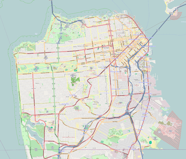
| Location | San Francisco, California |
| Coordinates | 37°45′36″N 122°26′52″W / 37.759948°N 122.4476864°WCoordinates: 37°45′36″N 122°26′52″W / 37.759948°N 122.4476864°W[1] |
| Area | 2.87 acres (1.16 ha)[1] |
| Elevation | 650 feet (198 m)[1] |
| Created | 1977 |
| Operated by | San Francisco Recreation & Parks Department |
Tank Hill Park is located in San Francisco near the intersection of Clayton Street and Twin Peaks Boulevard, which circumscribes the hill to the south and east. A rocky outcropping defines the north side, which falls in cliffs to houses below.
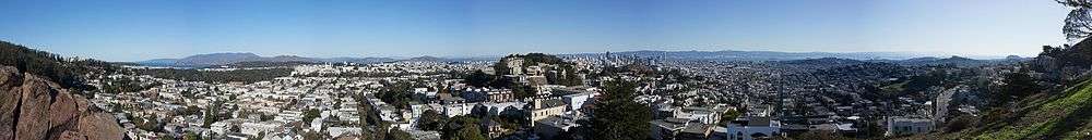
From the south, and higher side of the hill, along Twin Peaks Boulevard, steps and a path lead to the top of the hill, which offers wonderful views of downtown San Francisco and the Golden Gate.
The top of the hill offers flat and paved areas that date back to civic waterworks that once existed on the top of the hill.
Tank Hill is a popular area for local residents to gather to watch municipal fireworks on the 4th of July. Crissy Field, to the north, is the usual site of a large San Francisco fireworks display, but the hills also offers views of fireworks in Oakland and the East Bay.
See also
References
- 1 2 3 "Tank Hill". San Francisco Recreation & Parks. Retrieved 2014-03-04.
External links
- "Tank Hill". The Bandit Notes. Retrieved 2010-12-30.
- "Tank Hill". San Francisco Parks Alliance. Retrieved 2014-03-04.
- "Tank Hill Park, San Francisco". bcx.news. Retrieved 2015-04-23.
- "Tankhill Park". Geographic Names Information System. United States Geological Survey. Retrieved 2014-03-04.