Tamerna Djedida
| Tamerna Djedida | |
|---|---|
| Village | |
 Tamerna Djedida | |
| Coordinates: 33°26′47″N 5°57′23″E / 33.44639°N 5.95639°ECoordinates: 33°26′47″N 5°57′23″E / 33.44639°N 5.95639°E | |
| Country |
|
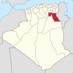
| Province | El Oued Province |
| District | Djamaâ District |
| Commune | Sidi Amrane[1] |
| Elevation | 63 m (207 ft) |
| Time zone | UTC+1 (CET) |
Tamerna Djedida is a village in the commune of Sidi Amrane,[1] in Djamaâ District, El Oued Province, Algeria. The village is located along a short road on the western side of the N3 highway 10 kilometres (6.2 mi) south of Djamaa.[2]
References
- 1 2 "Décret n° 84-365, fixant la composition, la consistance et les limites territoriale des communes. Wilaya d'El Oued" (PDF) (in French). Journal officiel de la République Algérienne,. 19 December 1984. p. 1565. Archived from the original (PDF) on 2 March 2013 or before. Retrieved 2 March 2013. Check date values in:
|archivedate=(help) - ↑ "Tamerna Djedida, Algeria". Google Maps. Retrieved 23 April 2013.
Neighbouring towns and cities
Places adjacent to Tamerna Djedida | ||||||||||
|---|---|---|---|---|---|---|---|---|---|---|
| ||||||||||
This article is issued from
Wikipedia.
The text is licensed under Creative Commons - Attribution - Sharealike.
Additional terms may apply for the media files.