Tambacounda Department
| Tambacounda | |
|---|---|
| Department | |
 | |
 Former location in the Tambacounda Region | |
| Country |
|
| Region | Tambacounda Region |
| Capital | Tambacounda |
| Area | |
| • Total | 20,328 km2 (7,849 sq mi) |
| Population (2013 census) | |
| • Total | 299,163 |
| • Density | 15/km2 (38/sq mi) |
| Time zone | UTC+0 (GMT) |
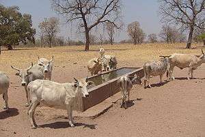
Tambacounda Department is one of the 45 departments of Senegal, and one of the four making up the Tambacounda Region. It formerly covered an area of 20,328 km² and in 2013 had an estimated population of 283,769. However in 2005 it was reduced in size to create the new Koumpentoum Department.
The department has one only urban commune, that of Tambacounda.
The rest of the department is divided into three arrondissements, which in turn are divided into rural districts (communautés rurales):
- Koussanar Arrondissement:
- Koussanar
- Sinthiou Malème
- Makacolibantang Arrondissement:
- Makacolibantang
- Niani Toucouleur
- Ndoga Babacar
- Missirah Arrondissement:
- Dialacoto
- Missirah
- Néttéboulou
Historic Sites [1]
- Railway Station and Railway Hotel in Tambacounda
- The building housing the Prefecture in Tambacounda
- Tata (fortification) of Maba at Ndoungoussine
- Wells and historic remains at Ndoungoussine
- Megalithic site at Thiékène Boussoura
- Megalithic site at Kodiam
- Megalithic site at Saré Diouldé
- Megalithic site at Saré Sékourou
References
- ↑ Historic sites Archived 2016-03-04 at the Wayback Machine.
Coordinates: 13°46′8″N 13°40′2″W / 13.76889°N 13.66722°W
This article is issued from
Wikipedia.
The text is licensed under Creative Commons - Attribution - Sharealike.
Additional terms may apply for the media files.