Tambacounda Airport
| Tambacounda Airport | |||||||||||
|---|---|---|---|---|---|---|---|---|---|---|---|
| Summary | |||||||||||
| Airport type | Public | ||||||||||
| Serves | Tambacounda, Senegal | ||||||||||
| Elevation AMSL | 161 ft / 49 m | ||||||||||
| Coordinates | 13°44′12″N 013°39′11″W / 13.73667°N 13.65306°W | ||||||||||
| Map | |||||||||||
 TUD Location within Senegal | |||||||||||
| Runways | |||||||||||
| |||||||||||
Tambacounda Airport (IATA: TUD, ICAO: GOTT) is an airport serving Tambacounda, the capital of the Tambacounda Region in Senegal.
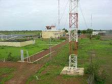
Airport telecommunication antennas and towers, with terminal in background, 2006.
References
- ↑ Airport information for GOTT from DAFIF (effective October 2006)
- ↑ Airport information for TUD at Great Circle Mapper. Source: DAFIF (effective October 2006).
External links
This article is issued from
Wikipedia.
The text is licensed under Creative Commons - Attribution - Sharealike.
Additional terms may apply for the media files.