Aguenar – Hadj Bey Akhamok Airport
| Aguenar – Hadj Bey Akhamok Airport Aéroport de Tamanrasset / Aguenar – Hadj Bey Akhamok | |||||||||||||||
|---|---|---|---|---|---|---|---|---|---|---|---|---|---|---|---|
 | |||||||||||||||
| Summary | |||||||||||||||
| Airport type | Public | ||||||||||||||
| Operator | EGSA Alger | ||||||||||||||
| Serves | Tamanrasset, Algeria | ||||||||||||||
| Elevation AMSL | 1,377 m / 4,518 ft | ||||||||||||||
| Coordinates | 22°48′40″N 05°27′03″E / 22.81111°N 5.45083°ECoordinates: 22°48′40″N 05°27′03″E / 22.81111°N 5.45083°E | ||||||||||||||
| Map | |||||||||||||||
 TMR Location of airport in Algeria | |||||||||||||||
| Runways | |||||||||||||||
| |||||||||||||||
| Statistics (2010) | |||||||||||||||
| |||||||||||||||
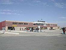
Aguenar – Hadj Bey Akhamok Airport (French: Aéroport de Tamanrasset / Aguenar – Hadj Bey Akhamok[3]) (IATA: TMR, ICAO: DAAT), also known as Aguenar Airport or Tamanrasset Airport, is an airport serving Tamanrasset, a city in the Tamanrasset Province of southern Algeria. It is located 3.6 nautical miles (6.7 km) northwest of the city.[3]
The airport was an alternative landing site for NASA's Space Shuttle, and has been used for American military operations.[7]
In the mid-2000s it was extensively upgraded to serve additionally as a military base, with 10 hardened aircraft shelters, aprons, personnel accommodation and other facilities[8]
Airlines and destinations
| Airlines | Destinations |
|---|---|
| Air Algérie[9] | Algiers, Bordj Badji Mokhtar, El Golea, Ghardaia, Illizi, In Salah, Oran, Ouargla |
| Tassili Airlines | Algiers, In Salah |
Statistics
| Passengers | Change from previous year | Aircraft operations | Change from previous year | Cargo (metric tons) | Change from previous year | |
|---|---|---|---|---|---|---|
| 2005 | 57,601 | 2,474 | 151 | |||
| 2006 | 55,826 | 2,729 | 182 | |||
| 2007 | 49,838 | 2,647 | 194 | |||
| 2008 | 59,116 | 2,593 | 151 | |||
| 2009 | 67,770 | 2,496 | 141 | |||
| 2010 | 70,515 | 2,402 | 149 | |||
| Source: Airports Council International. World Airport Traffic Reports (Years 2005,[10] 2006,[11] 2007,[12] 2009[13] and 2010) | ||||||
Incidents and accidents
- On 8 February 1978, Douglas C-49J N189UM of Aero Service Corporation was damaged beyond repair in a landing accident at Tamanrasset.[14]
- On 6 March 2003 Air Algérie Flight 6289 crashed at 3:45 pm local time (1445 GMT). The flight was leaving Tamanrasset bound for Algiers with the co-pilot acting as pilot-in-command. At a height of 78 feet and a speed of 158 kts, the No. 1 engine suffered a turbine failure. The captain took control. The co-pilot asked if she should raise the gear, but the captain did not respond. The Boeing 737-200 lost speed, stalled, and broke up on rocky terrain about 1600 metres past the runway. The accident was caused by the loss of an engine during a critical phase of flight, the non-retraction of the landing gear after the engine failure, and the Captain taking over control of the airplane before having clearly identified the problem. There were 102 fatalities and one survivor.
References
- ↑ http://www.azworldairports.com/airports/a1020tmr.cfm
- ↑ http://www.skyscanner.net/airports/tmr/tamanrasset-airport.html
- 1 2 3 (in French) AIP and Chart for Aéroport de Tamanrasset / Aguenar – Hadj Bey Akhamok (DAAT) from Service d'Information Aéronautique – Algérie
- ↑ (in French) Aéroport de Tamanrasset : Aguenar Hadj Bey Akhamokh from Établissement de Gestion de Services Aéroportuaires d'Alger (EGSA Alger)
- ↑ Airport information for DAAT at World Aero Data. Data current as of October 2006.Source: DAFIF.
- ↑ "DAAT @ aerobaticsweb.org". Landings.com. Retrieved 31 July 2013.
- ↑ Poynting, Scott; Whyte, David (2012). Counter-Terrorism and State Political Violence:. Routledge. p. 222. ISBN 9781136298486. Retrieved 20 January 2013.
- ↑ Google Earth imagery 8 May 2005 and 29 May 2006.
- ↑ "Air Algérie Route Map". Retrieved 21 January 2011.
- ↑ Airport Council International's 2005 World Airport Traffic Report
- ↑ Airport Council International's 2006 World Airport Traffic Report
- ↑ Airport Council International's 2007 World Airport Traffic Report
- ↑ Airport Council International Archived 11 August 2016 at the Wayback Machine.'s 2009 World Airport Traffic Report
- ↑ "N189UM Accident description". Aviation Safety Network. Retrieved 1 August 2010.
External links
This article is issued from
Wikipedia.
The text is licensed under Creative Commons - Attribution - Sharealike.
Additional terms may apply for the media files.