Taman Suropati
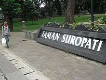
Taman Suropati (Suropati Park) is a park located in Menteng, Jakarta, Indonesia.
The location that would be Taman Suropati was hill-shaped area. The soil was dumped to Besuki Street in order to level the area.[1] The park was originally a court in circular form designed in 1912 by P.A.J. Moojen. F.J. Kubatz and F.J.L. Ghijsels perfected to avoid traffic jam in around the court.[2]
In 1920, the court started the transformation to be a park by the planting of trees and flowers.[2]
According to Zaenuddin HM, in his books 212 Asal Usul Djakarta Tempo Doeloe, originally the park was named Burgemeester Bisschopsplein as of the first Batavia burgemeester (mayor), G.J. Bisshop.[2][1] The park started to be called Taman Suropati after the independence.[2] The name Suropati was from a national hero Untung Suropati.[1]
Across the park, there was Logegebouw (now Bappenas building).[2] The park is located in the center of Menteng and is the meeting point of three streets: Teuku Umar Street, Diponegoro Street, and Imam Bonjol Street.[1]
Taman Suropati, as well as other park, was used by the citizen for taking a walk and relaxing.[2]
Taman Suropati was also used politically. According to Kompas, on 21 October 1965, Nahdlatul Ulama Jakarta Raya held a general meeting with other citizen supporting government policy at Konferensi Internasional Anti Pangkalan Asing (KIAPMA) and demanding the disbanding of Partai Komunis Indonesia.[2]
According to Kompas on 21 December 1984, there were six statues or monuments from other ASEAN founders and officially placed there on 20 December 1984.[2] Because of this, the park was considered peace or friendship symbol.[3]
See also
References
- 1 2 3 4 Abdullah, Nurudin (30 August 2014). "JAKARTA TEMPO DOELOE: Asal Usul Nama Taman Suropati". Bisnis.com. Retrieved 3 September 2015.
- 1 2 3 4 5 6 7 8 Mardiani, Annisa. "Rekreasi dan Beraksi di Taman Suropati". Historia.id. Historia. Retrieved 2 September 2015.
- ↑ Mulyani & Dwiharti 2011, p. 104.
Works cited
- Mulyani, Ade; Dwiharti, Wieke (2011). Jakarta: Panduan Wisata Tanpa Mal (in Indonesian). Gramedia Pustaka Utama. ISBN 9789792258202.