Takum
| Takum Ikam | |
|---|---|
| LGA and town | |
| Nickname(s): TTM | |
 Takum Location in Nigeria | |
| Coordinates: 7°15′N 9°59′E / 7.250°N 9.983°ECoordinates: 7°15′N 9°59′E / 7.250°N 9.983°E | |
| Country |
|
| State | Taraba State |
| Local Government Headquarters | Takum |
| Government | |
| • Local Government Chairman and the Head of the Local Government Council | Shiban Y. Tikari[1] |
| Area | |
| • Total | 2,503 km2 (966 sq mi) |
| Population (2006 census) | |
| • Total | 135,349 |
| Time zone | UTC+1 (WAT) |
| 3-digit postal code prefix | 671 |
| ISO 3166 code | NG.TA.TA |
Takum is a Local Government Area in Taraba State, Nigeria. Its headquarters are in the town of Takum, it is created out of Wukari local government in 1975, at7°16′00″N 9°59′00″E / 7.26667°N 9.98333°E. Takum borders the Republic of Cameroon in the south, Ussa Local Government to the west, Donga Local government to the north, District within Takum are Abuja, kwambai, jenuwa, Rogo, Dutse, Kashimbila, Bete, Chanchanji, Bika.
The ethnic tribes in Takum are Jukun, kuteb, Chamba, Ichen, Hausa/Fulani, Tiv[2]
It has an area of 2,503 km² and a population of 135,349 at the 2006 census.
The postal code of the area is 671.[3]
References
- ↑ http://tarabastate.gov.ng/local-govt-chairmen/
- ↑ www.kuteb.tripod.com
- ↑ "Post Offices- with map of LGA". NIPOST. Archived from the original on 2009-10-07. Retrieved 2009-10-20.
State capital: Jalingo | ||
| Local Government Areas | 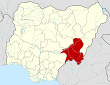 | |
This article is issued from
Wikipedia.
The text is licensed under Creative Commons - Attribution - Sharealike.
Additional terms may apply for the media files.