Tada, Nellore district
| Tada | |
|---|---|
| Village | |
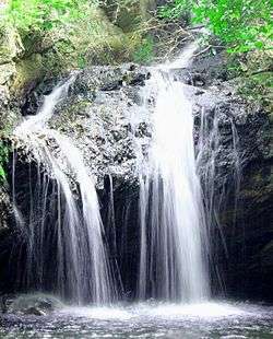 Tada Falls near SriCity | |
 Tada Location in Andhra Pradesh, India  Tada Tada (India) | |
| Coordinates: 13°35′11″N 80°02′11″E / 13.586311°N 80.036473°ECoordinates: 13°35′11″N 80°02′11″E / 13.586311°N 80.036473°E | |
| Country |
|
| State | Andhra Pradesh |
| District | Nellore district |
| Population (2011) | |
| • Total | 4,220 |
| Languages | |
| • Official | Telugu |
| Time zone | UTC+5:30 (IST) |
| PIN | 524401 |
| Telephone code | 08623 |
| Vehicle registration | AP 26 xx xxxx |
| Nearest city | Chennai, Tamil Nadu |
| Lok Sabha constituency | Tirupati |
| Vidhan Sabha constituency | Sullurpeta |
| Climate | hot (Köppen) |
Tada is a village in Nellore district of Andhra Pradesh.
Transport
National Highway 16, a part of Golden Quadrilateral highway network, bypasses the village.[1]
Languages
Telugu is the official and spoken language of the town[2].
References
- ↑ "National Highways Development Project Map". National Highways Authority of India. Archived from the original on 22 April 2017. Retrieved 21 April 2017.
- ↑ "Census Digital Library". 8 June 2017. Archived from the original on 2013-11-02. Retrieved 8 June 2017.
External links

This article is issued from
Wikipedia.
The text is licensed under Creative Commons - Attribution - Sharealike.
Additional terms may apply for the media files.