Ta Phraya District
| Ta Phraya ตาพระยา | |
|---|---|
| Amphoe | |
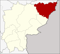 Amphoe location in Sa Kaeo Province | |
| Coordinates: 14°0′22″N 102°48′21″E / 14.00611°N 102.80583°ECoordinates: 14°0′22″N 102°48′21″E / 14.00611°N 102.80583°E | |
| Country | Thailand |
| Province | Sa Kaeo |
| Seat | Ta Phraya |
| Area | |
| • Total | 642.345 km2 (248.011 sq mi) |
| Population (2005) | |
| • Total | 52,284 |
| • Density | 81.4/km2 (211/sq mi) |
| Time zone | UTC+7 (ICT) |
| Postal code | 27180 |
| Geocode | 2703 |
Ta Phraya (Thai: ตาพระยา, pronounced [tāː pʰrā.jāː]) is the northeasternmost district (amphoe) of Sa Kaeo Province, eastern Thailand.
History
The area was originally dense forest in Aranyaprathet District. Later people moved to there for agricultural work. When the community grew bigger, the government created the Ta Phraya minor district (king amphoe) in 1959.[1] It was upgraded to a full district in 1963.[2]
This district gives its name to Ta Phraya National Park.
Geography
Neighboring districts are (from the south clockwise), Khok Sung and Watthana Nakhon of Sa Kaeo Province, Non Din Daeng and Lahan Sai of Buriram Province. To the east is Banteay Meanchey Province of Cambodia.
The Sankamphaeng Range mountainous area is in the northern section of this district.
Administration
The district is divided into five sub-districts (tambon), which are further subdivided into 61 villages (muban). Ta Phraya is a township (thesaban tambon) and covers parts of the tambon Ta Phraya. There are a further five tambon administrative organizations (TAO).
| No. | Name | Thai name | Villages | Pop. | |
|---|---|---|---|---|---|
| 1. | Ta Phraya | ตาพระยา | 17 | 15,132 | |
| 2. | Thap Sadet | ทัพเสด็จ | 13 | 7,929 | |
| 6. | Thap Rat | ทัพราช | 15 | 14,281 | |
| 7. | Thap Thai | ทัพไทย | 10 | 7,949 | |
| 9. | Kho Khlan | โคคลาน | 6 | 6,993 |
Missing numbers are tambon which now form Khok Sung District.
References
- ↑ ประกาศกระทรวงมหาดไทย เรื่อง ตั้งกิ่งอำเภอตาพระยา (PDF). Royal Gazette (in Thai). 76 (105 ง): 2481. November 10, 1959.
- ↑ พระราชกฤษฎีกาตั้งอำเภอบ่อพลอย อำเภอไทรโยค อำเภอหนองปรือ อำเภอหนองสองห้อง อำเภอประทาย อำเภอห้วยแถลง อำเภอละหานทราย อำเภอกุยบุรี อำเภอตาพระยา อำเภอหนองไผ่ อำเภอนาเชือก อำเภอวัดเพลง อำเภอพนัสนิคม อำเภอภูกระดึง อำเภอปรางค์กู่ อำเภอท่าช้าง อำเภอบ้านด่านลานหอย อำเภอบ้านดุง อำเภอสว่างอารมณ์ และอำเภอกุดชุม พ.ศ. ๒๕๐๖ (PDF). Royal Gazette (in Thai). 80 (72 ก): 362–366. July 16, 1963.