Tōjiin Station
Tōjiin Station
| |
|---|---|
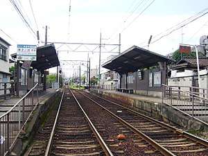 Station platforms, 2007 | |
| Location |
Kita-ku, Kyoto Kyoto Prefecture Japan |
| Coordinates | 35°01′40″N 135°43′27″E / 35.0278250°N 135.7240550°ECoordinates: 35°01′40″N 135°43′27″E / 35.0278250°N 135.7240550°E[1] |
| Operated by | Keifuku Electric Railroad |
| Line(s) | Randen Kitano Line |
| Distance | 0.7km from Kitano-Hakubaichō |
| Platforms | 2 |
| Tracks | 2 |
| Construction | |
| Structure type | At-grade |
| Other information | |
| Station code | B8 |
| Website | Official (in Japanese) |
| History | |
| Opened | November 3, 1925 |
| Traffic | |
| Passengers (FY2015[2]) | 0.2 million |
Tōjiin Station (等持院駅 Tōjiin-eki) is a tram stop in Ukyo-ku, Kyoto, Japan.[3] The station is serviced by the Randen Kitano Line that begins at Katabiranotsuji and continues to Kitano-Hakubaichō.[4]
Station layout
The station consists of two split-platforms at ground level. Platform 1 services trams to Katabiranotsuji, connecting with the Randen Arashiyama Line. Platform 2 services trams bound for Kitano-Hakubaichō.[5]
Adjacent stations
| « | Service | » | ||
|---|---|---|---|---|
| Randen Kitano Line | ||||
| Ryōanji (B7) | Local | Kitano-Hakubaichō (B9) | ||
References
- ↑ "Node: Tōjiin (335664938)". OpenStreetMap. Retrieved 2010-10-11.
- ↑ 第8章 都市施設 [Chapter 8: Urban facilities]. 京都市統計書 [Statistics of Kyoto City] (in Japanese). City of Kyoto. 2017.
- ↑ (in Japanese) "等持院". Keifuku Electric Railroad Co., Ltd. (Randen). Retrieved 2010-10-11.
- ↑ "Keifuku Line (Randen)". Discover Kyoto. Retrieved 2010-10-11.
- ↑ "Station Map". Arukumachi KYOTO Route Planner. Retrieved 2010-10-11.
External links

- Keifuku Electric Railroad Randen official summary page (English)
This article is issued from
Wikipedia.
The text is licensed under Creative Commons - Attribution - Sharealike.
Additional terms may apply for the media files.