Täschhorn
| Täschhorn | |
|---|---|
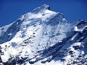 West face of the Täschhorn | |
| Highest point | |
| Elevation | 4,491 m (14,734 ft) |
| Prominence | 210 m ↓ Domjoch |
| Isolation | 1.2 km → Dom |
| Parent peak | Dom |
| Coordinates | 46°05′01″N 7°51′26″E / 46.08361°N 7.85722°ECoordinates: 46°05′01″N 7°51′26″E / 46.08361°N 7.85722°E |
| Geography | |
 Täschhorn Location in Switzerland | |
| Location | Valais, Switzerland |
| Parent range | Pennine Alps |
| Climbing | |
| First ascent | 30 July 1862 by the Rev. John Llewelyn-Davies and Rev. J. W. Hayward with Stefan and Johann Zumtaugwald and Peter-Josef Summermatter |
| Easiest route | SSE ridge at AD |
The Täschhorn (4,491 m) is a mountain in the Pennine Alps in Switzerland, lying south of the Dom within the Mischabel range.
The first ascent of the mountain was by the Rev. John Llewelyn-Davies and Rev. J. W. Hayward with guides Stefan and Johann Zumtaugwald and Peter-Josef Summermatter on 30 July 1862.
External links
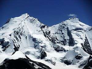
The Dom (left) and Täschhorn (right) from the north-west
This article is issued from
Wikipedia.
The text is licensed under Creative Commons - Attribution - Sharealike.
Additional terms may apply for the media files.