Ellington, Missouri
| Ellington, Missouri | |
|---|---|
| City | |
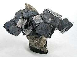 Galena from the Sweetwater Mine, near Ellington | |
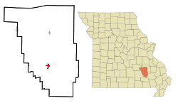 Location of Ellington, Missouri | |
| Coordinates: 37°14′21″N 90°58′11″W / 37.23917°N 90.96972°WCoordinates: 37°14′21″N 90°58′11″W / 37.23917°N 90.96972°W | |
| Country | United States |
| State | Missouri |
| County | Reynolds |
| Area[1] | |
| • Total | 1.38 sq mi (3.57 km2) |
| • Land | 1.38 sq mi (3.57 km2) |
| • Water | 0 sq mi (0 km2) |
| Elevation | 663 ft (202 m) |
| Population (2010)[2] | |
| • Total | 987 |
| • Estimate (2016)[3] | 962 |
| • Density | 720/sq mi (280/km2) |
| Time zone | UTC-6 (Central (CST)) |
| • Summer (DST) | UTC-5 (CDT) |
| ZIP code | 63638 |
| Area code(s) | 573 |
| FIPS code | 29-21844[4] |
| GNIS feature ID | 0717476[5] |
Ellington is a city in Reynolds County, Missouri, United States. The population was 987 at the 2010 census. In 1925, the infamous Tri-State Tornado began just northwest of Ellington.
History
Ellington was laid out in 1856 by Cliny Huff Ellington, and named for her.[6] An early variant name was "Logan's Creek".[6] A post office called Logan's Creek was established in 1845, and the name was changed to Ellington in 1895.[7]
The Civil War Fortification at Barnesville was listed on the National Register of Historic Places in 1998.[8]
Geography
Ellington is located at 37°14′21″N 90°58′11″W / 37.23917°N 90.96972°W (37.239103, -90.969669).[9]
According to the United States Census Bureau, the city has a total area of 1.38 square miles (3.57 km2), all land.[1] Being located within thirty miles of Eminence, Van Buren, and Lesterville makes Ellington a popular stop among Ozark National Scenic Riverways tourists.
Sweetwater lead mine
The Sweetwater Mine is located approximately 12 miles northwest of Ellington and is owned by the Doe Run Company. The mine produces lead and zinc.[10]
Demographics
| Historical population | |||
|---|---|---|---|
| Census | Pop. | %± | |
| 1920 | 452 | — | |
| 1930 | 655 | 44.9% | |
| 1940 | 849 | 29.6% | |
| 1950 | 777 | −8.5% | |
| 1960 | 812 | 4.5% | |
| 1970 | 1,094 | 34.7% | |
| 1980 | 1,215 | 11.1% | |
| 1990 | 994 | −18.2% | |
| 2000 | 1,045 | 5.1% | |
| 2010 | 987 | −5.6% | |
| Est. 2016 | 962 | [3] | −2.5% |
| U.S. Decennial Census[11] | |||
2010 census
As of the census[2] of 2010, there were 987 people, 407 households, and 241 families residing in the city. The population density was 715.2 inhabitants per square mile (276.1/km2). There were 488 housing units at an average density of 353.6 per square mile (136.5/km2). The racial makeup of the city was 98.38% White, 0.20% Black or African American, 0.41% Native American, 0.20% Asian, and 0.81% from two or more races. Hispanic or Latino of any race were 1.11% of the population.
There were 407 households of which 37.3% had children under the age of 18 living with them, 39.8% were married couples living together, 15.2% had a female householder with no husband present, 4.2% had a male householder with no wife present, and 40.8% were non-families. 34.2% of all households were made up of individuals and 19.7% had someone living alone who was 65 years of age or older. The average household size was 2.42 and the average family size was 3.08.
The median age in the city was 37.1 years. 27.8% of residents were under the age of 18; 8.4% were between the ages of 18 and 24; 23.1% were from 25 to 44; 24.2% were from 45 to 64; and 16.7% were 65 years of age or older. The gender makeup of the city was 45.8% male and 54.2% female.
2000 census
As of the census[4] of 2000, there were 1,045 people, 456 households, and 285 families residing in the city. The population density was 740.8 people per square mile (286.2/km²). There were 535 housing units at an average density of 379.3 per square mile (146.5/km²). The racial makeup of the city was 96.08% White, 0.77% Native American, 0.77% Asian, 0.48% from other races, and 1.91% from two or more races. Hispanic or Latino of any race were 0.96% of the population.
There were 456 households out of which 32.2% had children under the age of 18 living with them, 47.1% were married couples living together, 12.5% had a female householder with no husband present, and 37.5% were non-families. 35.1% of all households were made up of individuals and 18.9% had someone living alone who was 65 years of age or older. The average household size was 2.29 and the average family size was 2.93.
In the city the population was spread out with 26.7% under the age of 18, 8.7% from 18 to 24, 26.8% from 25 to 44, 20.1% from 45 to 64, and 17.7% who were 65 years of age or older. The median age was 35 years. For every 100 females there were 85.3 males. For every 100 females age 18 and over, there were 83.7 males.
The median income for a household in the city was $21,836, and the median income for a family was $27,443. Males had a median income of $26,172 versus $16,250 for females. The per capita income for the city was $12,026. About 16.4% of families and 21.2% of the population were below the poverty line, including 30.3% of those under age 18 and 15.4% of those age 65 or over.
Education
Southern Reynolds County R-II School District operates two schools at Ellington: Southern Elementary School and Southern High School.[12]
Ellington has a public library, a branch of the Reynolds County Library District.[13]
Climate
Ellington has a humid subtropical climate (Köppen climate classification Cfa).
| Climate data for Ellington | |||||||||||||
|---|---|---|---|---|---|---|---|---|---|---|---|---|---|
| Month | Jan | Feb | Mar | Apr | May | Jun | Jul | Aug | Sep | Oct | Nov | Dec | Year |
| Average high °F (°C) | 42 (6) |
50 (10) |
59 (15) |
71 (22) |
79 (26) |
87 (31) |
92 (33) |
90 (32) |
81 (27) |
70 (21) |
57 (14) |
46 (8) |
69 (20) |
| Average low °F (°C) | 20 (−7) |
24 (−4) |
33 (1) |
42 (6) |
51 (11) |
61 (16) |
66 (19) |
63 (17) |
56 (13) |
43 (6) |
34 (1) |
24 (−4) |
43 (6) |
| Average precipitation inches (mm) | 3.11 (79) |
3.07 (78) |
4.50 (114.3) |
4.50 (114.3) |
4.48 (113.8) |
3.72 (94.5) |
3.87 (98.3) |
3.55 (90.2) |
3.36 (85.3) |
3.14 (79.8) |
4.82 (122.4) |
3.99 (101.3) |
46.11 (1,171.2) |
| Source: [14] | |||||||||||||
Notable residents
- Carter M. Buford (1876-1959), multi-term Missouri State Senator, was born and educated in Ellington[15]
See also
Footnotes
- 1 2 "US Gazetteer files 2010". United States Census Bureau. Archived from the original on 2012-01-24. Retrieved 2012-07-08.
- 1 2 "American FactFinder". United States Census Bureau. Retrieved 2012-07-08.
- 1 2 "Population and Housing Unit Estimates". Retrieved June 9, 2017.
- 1 2 "American FactFinder". United States Census Bureau. Archived from the original on 2013-09-11. Retrieved 2008-01-31.
- ↑ "US Board on Geographic Names". United States Geological Survey. 2007-10-25. Retrieved 2008-01-31.
- 1 2 "Reynolds County Place Names, 1928–1945". The State Historical Society of Missouri. Archived from the original on June 24, 2016. Retrieved December 13, 2016.
- ↑ "Post Offices". Jim Forte Postal History. Retrieved 13 December 2016.
- ↑ National Park Service (2010-07-09). "National Register Information System". National Register of Historic Places. National Park Service.
- ↑ "US Gazetteer files: 2010, 2000, and 1990". United States Census Bureau. 2011-02-12. Retrieved 2011-04-23.
- ↑ Sweetwater Mine at Mindat.org
- ↑ "Census of Population and Housing". Census.gov. Archived from the original on May 12, 2015. Retrieved June 4, 2015.
- ↑ "Southern Reynolds County R-Ii School District". Great Schools. Retrieved 17 March 2018.
- ↑ "Contact Information". Reynolds County Library District. Retrieved 17 March 2018.
- ↑ "Average weather for Ellington, Missouri". Weather.com. Retrieved December 21, 2008.
- ↑ "Senator C.M. Buford," Reynolds County Courier, July 2, 1959.
| Wikimedia Commons has media related to Sweetwater Mine. |
Municipalities and communities of Reynolds County, Missouri, United States | ||
|---|---|---|
| Cities |  | |
| Townships | ||
| Unincorporated communities | ||
| Ghost towns | ||
| Footnotes | ‡This populated place also has portions in an adjacent county or counties | |