Svolvær Airport, Helle
| Svolvær Airport, Helle Svolvær lufthavn, Helle | |||||||||||
|---|---|---|---|---|---|---|---|---|---|---|---|
 Svolvær Airport terminal building. | |||||||||||
| Summary | |||||||||||
| Airport type | Public | ||||||||||
| Operator | Avinor | ||||||||||
| Serves | Svolvær | ||||||||||
| Location | Helle | ||||||||||
| Elevation AMSL | 29 ft / 9 m | ||||||||||
| Coordinates | 68°14′35.88″N 14°40′09.12″E / 68.2433000°N 14.6692000°ECoordinates: 68°14′35.88″N 14°40′09.12″E / 68.2433000°N 14.6692000°E | ||||||||||
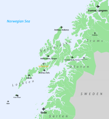
| Map | |||||||||||
 SVJ | |||||||||||
| Runways | |||||||||||
| |||||||||||
| Statistics (2014) | |||||||||||
| |||||||||||
Svolvær Airport, Helle (Norwegian: Svolvær lufthavn, Helle) (IATA: SVJ, ICAO: ENSH) is a regional airport serving the town of Svolvær in Vågan municipality (and the region surrounding Svolvær) in Nordland county, Norway.
Service
The airport is operated by Avinor. It is served by Widerøe with Dash 8 aircraft connecting the community to Bodø and other communities in Nordland. The services are all on subsidized public service obligation routes administered by the Norwegian Ministry of Transportation and Communication.
In 2014, Svolvær Airport had 74,496 passengers. In 2007, a new road (Lofoten Mainland Connection) opened which allows driving to the Harstad/Narvik Airport, but Svolvær Airport has kept its passenger figures.
Airlines and destinations
| Airlines | Destinations |
|---|---|
| Widerøe | Bodø, Leknes, Oslo-Gardermoen,[3] Stokmarknes,[4] Tromsø[3] |
Ground transportation
There is no bus service to the airport, but taxis are available. The airport is located at Helle, about 6 kilometres (3.7 mi) east of the town.
Future
Avinor is planning building a new primary airport to serve Lofoten and possibly also Vesterålen. The region wants to be more attractive on the conference market which would create more job opportunities outside the tourist season, and there is a need to adopt airports to modern aircraft types.
Two locations have been put forward, Gimsøya (68°19′10″N 14°9′30″E / 68.31944°N 14.15833°E) and Hadselsanden (68°25′40″N 14°37′30″E / 68.42778°N 14.62500°E). The former could replace Leknes Airport and Svolvær Airport, Helle, the latter could also replace Stokmarknes Airport. As both alternatives imply direct services to Oslo, the leakage to Evenes Airport would be reduced.[5] Gimsøy was the most favoured alternative since Stokmarknes needs ferry access if its airport is replaced, or a future tunnel which seems to expensive, and because Hadselsanden is fairly distant from Leknes (113 kilometers (70 mi)). However weather recordings has shown that Gimsøy, located at the big ocean, is too windy and foggy for an airport.[6] Therefore, the main option now is to extend Leknes, considering that Svolvær airport has no room for extension.
There are plans to build a tunnel along the road E10 which would reduce the road distance from Svolvær to Gimsøy and Leknes by 7 kilometers (4.3 mi) and 6 minutes.[7]
References
- ↑ "Månedsrapport" (XLS). Avinor. 2015. Retrieved 13 January 2015.
- ↑ "Airport information for ENSH" (PDF). Avinor. Retrieved 9 April 2012.
- 1 2 http://www.wideroe.no/Nyhetsarkiv/Tidenes-storsatsning-p-direkteruter-til-Lofoten-og-Helgeland/FECB24C1-8926-4669-921E-CB6BD2B86293/1
- ↑ wideroe.no
- ↑ "Nasjonal transportplan 2014–2023: Framtidsrettet utvikling av lufthavnstrukturen" (PDF) (in Norwegian). Avinor. 15 February 2012. pp. 46–48. Archived (PDF) from the original on 28 February 2013. Retrieved 17 February 2013.
- ↑ Gimsøya ikke tilfredsstillende som flyplasslokasjon i Lofoten (Lofotposten 23. November 2016)
- ↑ E10 Fiskebøl–Å (KVU)